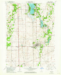
1962 Map of Lowell
USGS Topo · Published 1964About this map
Lowell serves as the primary hub for this portion of Lake County, Indiana, surrounded by a transition from organized town grids to rural townships like Hanover and Cedar Creek. The landscape is defined by the winding course of Cedar Creek, which connects the larger Cedar Lake in the north to the recreational developments around Lake Dalecarlia and Redwing Lake. Industrial and transportation corridors are visible through the Monon Railroad corridor, which links small settlements like Creston and Belshaw. Local social life and education of the early 1960s are evidenced by numerous institutions including Oak Hill School, Lake Prairie Church, and the South Shore Country Club. Near the western edge, the grid gives way to the open terrain of the West Creek township and the Illinois State Line, where Bailey Airport and a localized Pumping Station reflect the regional infrastructure of the era.
Find a feature on this map
52 named features on this map. Tap any name to fly to it.
Don’t see what you’re looking for? This feature index may not catch every label — zoom into the map to look around manually.
Map Details
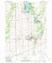
Editions of this 1962 Lowell Map
2 editions found
Other maps of this area

1922 · Momence
USGS Topo · 1:62,500

1924 · Momence
USGS Topo · 1:62,500

1929 · Dyer
USGS Topo · 1:24,000

1930 · Dyer
USGS Topo · 1:24,000

1949 · Crete
USGS Topo · 1:62,500

1953 · Leroy
USGS Topo · 1:24,000

1953 · St. John
USGS Topo · 1:24,000

1953 · Crown Point
USGS Topo · 1:24,000

1953 · Beecher East
USGS Topo · 1:24,000
1953 · Dyer
USGS Topo · 1:24,000