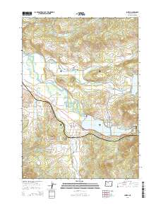
2014 Map of Lowell
USGS Topo · Published 2014About this map
Lowell and the neighboring community of Dexter anchor this 2014 survey of the central Oregon landscape where the Middle Fork Willamette River meets numerous drainages. The map reveals a region defined by its water management and historic transportation links, featuring the expansive Dexter Reservoir and the western edge of Lookout Point Lake. A notable concentration of historic timber-framed spans remains in the area, including the Pengra Covered Bridge near Fall Creek and the Unity Covered Bridge over Unity Fall Creek.
Find a feature on this map
67 named features on this map. Tap any name to fly to it.
Don’t see what you’re looking for? This feature index may not catch every label — zoom into the map to look around manually.
Map Details
Editions of this 2014 Lowell Map
This is the sole edition of this map. No revisions or reprints were ever made.
Other maps of this area

1935 · Lowell
USGS Topo · 1:96,000

1942 · Lowell
USGS Topo · 1:125,000

1950 · Marcola
USGS Topo · 1:62,500

1951 · Leaburg
USGS Topo · 1:62,500

1952 · Marcola
USGS Topo · 1:62,500

1953 · Salem
USGS Topo · 1:250,000

1954 · Salem
USGS Topo · 1:250,000

1955 · Hardesty Mtn
USGS Topo · 1:62,500

1955 · Lowell
USGS Topo · 1:62,500

1958 · Roseburg
USGS Topo · 1:250,000