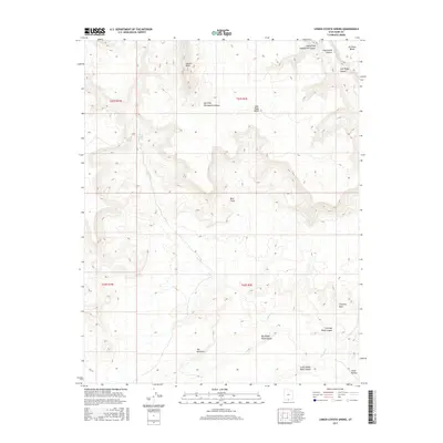
2017 Map of Lower Coyote Spring
USGS Topo · Published 2017About this map
Lower Coyote Spring and the drainage of Coyote Cr dominate this section of the Kane County landscape, where the topography is defined by complex canyon systems and high benches. The map reveals a land shaped by water and erosion, featuring several prominent geological formations such as Chimney Rock and the striated formations of The Rimrocks. These landmarks, along with Coyote Point, served as critical navigational aids in a region where vertical relief often dictated movement.
Find a feature on this map
21 named features on this map. Tap any name to fly to it.
Don’t see what you’re looking for? This feature index may not catch every label — zoom into the map to look around manually.
Map Details
Editions of this 2017 Lower Coyote Spring Map
This is the sole edition of this map. No revisions or reprints were ever made.
Other maps of this area

1886 · Escalante
USGS Topo · 1:250,000

1922 · Upper Last Chance
USGS Topo · 1:63,360

1953 · Nipple Butte
USGS Topo · 1:62,500

1954 · Paria NW
USGS Topo · 1:24,000
1954 · Paria SW
USGS Topo · 1:24,000

1954 · Paria
USGS Topo · 1:62,500

1955 · The Cockscob SW
USGS Topo · 1:24,000

1956 · Escalante
USGS Topo · 1:250,000

1960 · Escalante
USGS Topo · 1:250,000

1964 · Horse Flat
USGS Topo · 1:24,000