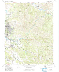
1993 Map of Lower Lake
USGS Topo · Published 1993About this map
Anderson Marsh State Historical Park anchors the western edge of this landscape, protecting the wetlands where Cache Creek begins its journey eastward. This 1993 revision documents the growth of Clearlake and the community of Lower Lake, showing the expansion of residential street grids alongside local landmarks like Pearce Field and Yuba College. The terrain quickly rises from the flat expanse of Anderson Flat into a complex system of ridges and canyons, including Quackenbush Mountain and Bally Peak.
Find a feature on this map
50 named features on this map. Tap any name to fly to it.
Don’t see what you’re looking for? This feature index may not catch every label — zoom into the map to look around manually.
Map Details
Editions of this 1993 Lower Lake Map
2 editions found
Other maps of this area

1920 · Venado
USGS Topo · 1:62,500

1924 · Bartlett Springs
USGS Topo · 1:62,500

1942 · Bartlett Springs
USGS Topo · 1:62,500

1943 · Morgan Valley
USGS Topo · 1:62,500

1944 · Bartlett Springs
USGS Topo · 1:62,500

1944 · Wilbur Springs
USGS Topo · 1:62,500

1944 · Morgan Valley
USGS Topo · 1:62,500

1945 · Lower Lake
USGS Topo · 1:62,500

1947 · Santa Rosa
USGS Topo · 1:250,000

1949 · Santa Rosa
USGS Topo · 1:250,000