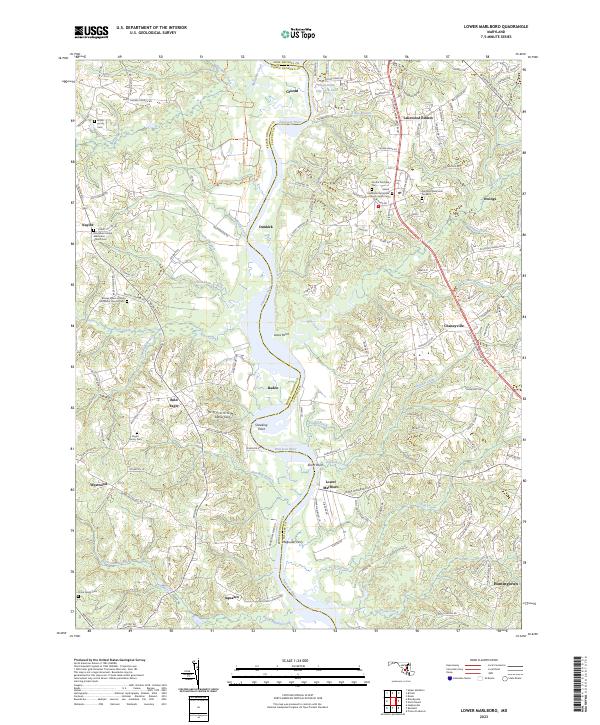
2023 Map of Lower Marlboro
USGS Topo · Published 2023About this map
The Patuxent River serves as the central artery for this region of Southern Maryland, carving a path between Prince George's and Calvert Counties. This survey documents a landscape where historic landings and crossings like Magruder Ferry once tied together the riverside communities of Lower Marlboro and Baden. The settlement pattern reflects deep-rooted local lineages, evidenced by numerous small burying grounds such as the Bowie Family Cem and Naylor Family Cem that pepper the interior ridges.
Find a feature on this map
157 named features on this map. Tap any name to fly to it.
Don’t see what you’re looking for? This feature index may not catch every label — zoom into the map to look around manually.
Map Details
Editions of this 2023 Lower Marlboro Map
This is the sole edition of this map. No revisions or reprints were ever made.
Other maps of this area

1892 · Prince Frederick
USGS Topo · 1:62,500

1892 · Brandywine
USGS Topo · 1:62,500

1892 · Owensville
USGS Topo · 1:62,500

1895 · Prince Frederick
USGS Topo · 1:62,500

1895 · Brandywine
USGS Topo · 1:62,500

1895 · Owensville
USGS Topo · 1:62,500

1899 · Patuxent
USGS Topo · 1:125,000

1900 · Washington
USGS Topo · 1:62,500

1901 · Prince Frederick
USGS Topo · 1:62,500

1905 · Owensville
USGS Topo · 1:62,500