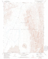
1969 Map of Lower Pahranagat Lake SW
USGS Topo · Published 1986About this map
Desert National Wildlife Range encompasses this basin-and-range landscape, defined by the stark transition between the valley floor and the towering peaks of the Sheep Range and Pahranagat Range. In the lower elevations, the Desert Lake (Depression) serves as a focal point for the region's drainage, surrounded by shifting Sand Dunes. The land's human history is marked by the Old Corn Creek Road, a primitive route that traverses the arid flats of the Desert National Wildlife Range. The convergence of these geological features highlights the characteristic isolation of Lincoln County, where seasonal water patterns and ancient wind-formed deposits dictate the layout of the desert floor.
Find a feature on this map
6 named features on this map. Tap any name to fly to it.
Don’t see what you’re looking for? This feature index may not catch every label — zoom into the map to look around manually.
Map Details
Editions of this 1969 Lower Pahranagat Lake SW Map
2 editions found
Other maps of this area

1907 · Las Vegas
USGS Topo · 1:250,000

1908 · Las Vegas
USGS Topo · 1:250,000

1945 · Sheep Range
USGS Topo · 1:125,000

1945 · Alamo
USGS Topo · 1:125,000

1954 · Caliente
USGS Topo · 1:250,000

1954 · Las Vegas
USGS Topo · 1:250,000

1957 · Las Vegas
USGS Topo · 1:250,000

1959 · Caliente
USGS Topo · 1:250,000

1959 · Las Vegas
USGS Topo · 1:250,000

1962 · Las Vegas
USGS Topo · 1:250,000