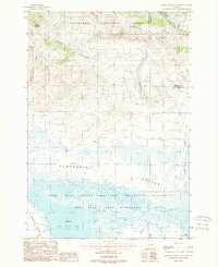
1988 Map of Lower Red Rock Lake
USGS Topo · Published 1988About this map
Lower Red Rock Lake dominates this high-altitude landscape in the Centennial Valley, reflecting a period when conservation and wilderness preservation defined the region's land use. Within the Red Rock Lakes National Wildlife Refuge and the dedicated Red Rock Lakes Wilderness, the map details a complex network of wetlands and drainage, including Odell Creek, Sparrow Slough, and Nye Creek. To the north, the terrain rises sharply into the Beaverhead National Forest, where Landon Ridge and Patchtop Mountain overlook the valley floor. The survey also captures human intersections with the environment, such as the Gravel Pit near the western edge and the boundary between Beaverhead and Madison counties, which cuts through the high ridges of the northeast corner.
Find a feature on this map
24 named features on this map. Tap any name to fly to it.
Don’t see what you’re looking for? This feature index may not catch every label — zoom into the map to look around manually.
Map Details
Editions of this 1988 Lower Red Rock Lake Map
This is the sole edition of this map. No revisions or reprints were ever made.
Other maps of this area

1950 · Cliff Lake
USGS Topo · 1:62,500

1950 · Lower Red Rock Lake
USGS Topo · 1:62,500

1950 · Monument Ridge
USGS Topo · 1:62,500

1950 · Upper Red Rock Lake
USGS Topo · 1:62,500

1955 · Ashton
USGS Topo · 1:250,000

1958 · Ashton
USGS Topo · 1:250,000

1960 · Ashton
USGS Topo · 1:250,000
1988 · Eureka Basin
USGS Topo · 1:24,000
1988 · Freezeout Mountain
USGS Topo · 1:24,000
1988 · Upper Red Rock Lake
USGS Topo · 1:24,000