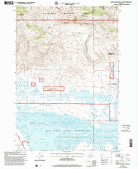
1997 Map of Lower Red Rock Lake
USGS Topo · Published 2002About this map
Centennial Valley serves as a stark topographical divide in this late 20th-century survey, separating the high peaks of the Beaverhead National Forest from the expansive wetlands of the Red Rock Lakes National Wildlife Refuge. To the north, the terrain climbs sharply toward Patchtop Mountain and along Landon Ridge, where drainage from Snowshoe Creek feeds the valley floor. Landon Camp sits at the northeastern edge, marking a point of human activity near the boundary between Madison and Beaverhead counties.
Find a feature on this map
18 named features on this map. Tap any name to fly to it.
Don’t see what you’re looking for? This feature index may not catch every label — zoom into the map to look around manually.
Map Details
Editions of this 1997 Lower Red Rock Lake Map
This is the sole edition of this map. No revisions or reprints were ever made.
Other maps of this area

1950 · Cliff Lake
USGS Topo · 1:62,500

1950 · Lower Red Rock Lake
USGS Topo · 1:62,500

1950 · Monument Ridge
USGS Topo · 1:62,500

1950 · Upper Red Rock Lake
USGS Topo · 1:62,500

1955 · Ashton
USGS Topo · 1:250,000

1958 · Ashton
USGS Topo · 1:250,000

1960 · Ashton
USGS Topo · 1:250,000
1988 · Eureka Basin
USGS Topo · 1:24,000
1988 · Freezeout Mountain
USGS Topo · 1:24,000
1988 · Lower Red Rock Lake
USGS Topo · 1:24,000