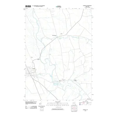
2010 Map of Lowville
USGS Topo · Published 2010About this map
Lowville and the winding course of the Black River anchor this 2010 survey of Lewis County, New York. The river's serpentine oxbows dominate the central landscape, creating a complex hydrologic network fed by numerous tributaries including Mill Creek, Rainbow Creek, and Hodge Creek. This modern survey documents the established village of Lowville alongside smaller communities like Dadville, Watson, and New Bremen.
Find a feature on this map
18 named features on this map. Tap any name to fly to it.
Don’t see what you’re looking for? This feature index may not catch every label — zoom into the map to look around manually.
Map Details
Editions of this 2010 Lowville Map
This is the sole edition of this map. No revisions or reprints were ever made.
Other maps of this area

1902 · Carthage
USGS Topo · 1:62,500

1904 · Carthage
USGS Topo · 1:62,500

1905 · Port Leyden
USGS Topo · 1:62,500

1906 · Highmarket
USGS Topo · 1:62,500

1907 · Port Leyden
USGS Topo · 1:62,500

1911 · Lowville
USGS Topo · 1:62,500

1913 · Lowville
USGS Topo · 1:62,500

1940 · Port Leyden
USGS Topo · 1:62,500

1943 · West Lowville
USGS Topo · 1:31,680

1943 · Carthage
USGS Topo · 1:31,680