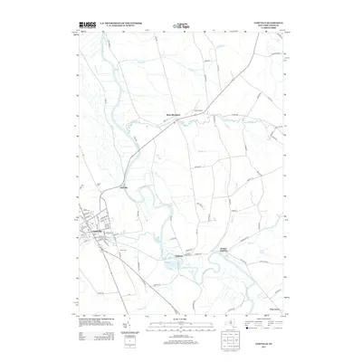
2013 Map of Lowville
USGS Topo · Published 2013About this map
The Black River winds through the heart of this Lewis County landscape, serving as a primary geographical anchor between the village of Lowville and the surrounding hamlets. This 2013 survey illustrates the local infrastructure and land use patterns, including Ross Farms and the smaller settlements of Dadville and Watson. The hydrology is particularly detailed, showing the confluence of several tributaries such as Crystal Cr, Mill Cr, and Butler Cr as they feed into the main river channel. Local history and genealogy are well-represented by established landmarks like Ebblie Cem and Beaches Bridge Cem, alongside transportation features including Duflo Airport. To the north, the community of New Bremen sits near Crystal Pond, while the eastern edge of the map reaches toward Bushes Landing and Pine Grove, reflecting the region's enduring rural character and its orientation toward the river valley.
Find a feature on this map
85 named features on this map. Tap any name to fly to it.
Don’t see what you’re looking for? This feature index may not catch every label — zoom into the map to look around manually.
Map Details
Editions of this 2013 Lowville Map
This is the sole edition of this map. No revisions or reprints were ever made.
Other maps of this area

1902 · Carthage
USGS Topo · 1:62,500

1904 · Carthage
USGS Topo · 1:62,500

1905 · Port Leyden
USGS Topo · 1:62,500

1906 · Highmarket
USGS Topo · 1:62,500

1907 · Port Leyden
USGS Topo · 1:62,500

1911 · Lowville
USGS Topo · 1:62,500

1913 · Lowville
USGS Topo · 1:62,500

1940 · Port Leyden
USGS Topo · 1:62,500

1943 · West Lowville
USGS Topo · 1:31,680

1943 · Carthage
USGS Topo · 1:31,680