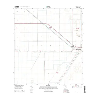
2015 Map of Loxahatchee NW
USGS Topo · Published 2015About this map
West Palm Beach Canal cuts diagonally through the heart of the Florida Everglades, defining the engineered agricultural landscape of Palm Beach County. This 2015 survey shows a grid-dominated environment where massive infrastructure projects dictate the flow of water and commerce. The junction at Twentymile Bend serves as a primary transit point where SR-80 and several waterways converge. In the eastern portion of the map, the edge of Wellington begins to appear, signaling the boundary between the expansive western drainage districts and the residential expansion of the coastal plain. The map detail highlights the complex network of artificial waterways like the Ocean Canal and L-7 Canal, which are vital for water management and irrigation in this low-lying region.
Find a feature on this map
15 named features on this map. Tap any name to fly to it.
Don’t see what you’re looking for? This feature index may not catch every label — zoom into the map to look around manually.
Map Details
Editions of this 2015 Loxahatchee NW Map
This is the sole edition of this map. No revisions or reprints were ever made.
Other maps of this area

1956 · West Palm Beach
USGS Topo · 1:250,000

1957 · West Palm Beach
USGS Topo · 1:250,000

1958 · West Palm Beach
USGS Topo · 1:250,000
1970 · West Palm Beach 2 SW
USGS Topo · 1:24,000
1970 · Loxahatchee SE
USGS Topo · 1:24,000
1970 · Loxahatchee NW
USGS Topo · 1:24,000
1970 · Loxahatchee SW
USGS Topo · 1:24,000
1970 · Shawano
USGS Topo · 1:24,000
1970 · Bryant
USGS Topo · 1:24,000
1970 · Sixmile Bend
USGS Topo · 1:24,000