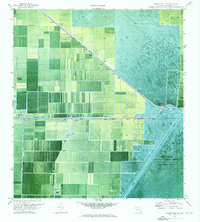
1970 Map of Loxahatchee NW
USGS Topo · Published 1976About this map
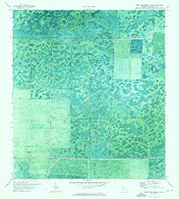
The Loxahatchee National Wildlife Refuge and Conservation Area No 1 dominate this 1970 orthophotomosaic, illustrating the managed intersection of Florida's wild wetlands and agricultural expansion. Engineered water control defines the landscape, anchored by the prominent West Palm Beach Canal which cuts diagonally across the sheet toward the sharp turn at Twentymile Bend.
Find a feature on this map
9 named features on this map. Tap any name to fly to it.
Don’t see what you’re looking for? This feature index may not catch every label — zoom into the map to look around manually.
Map Details
Editions of this 1970 Loxahatchee NW Map
2 editions found

Other maps of this area

1956 · West Palm Beach
USGS Topo · 1:250,000

1957 · West Palm Beach
USGS Topo · 1:250,000

1958 · West Palm Beach
USGS Topo · 1:250,000
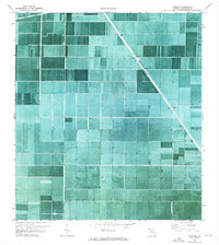
1970 · West Palm Beach 2 SW
USGS Topo · 1:24,000
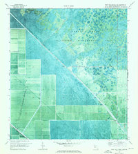
1970 · Loxahatchee SE
USGS Topo · 1:24,000

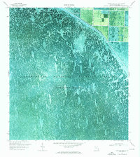
1970 · Loxahatchee SW
USGS Topo · 1:24,000
1970 · Shawano
USGS Topo · 1:24,000

1970 · Bryant
USGS Topo · 1:24,000

1970 · Sixmile Bend
USGS Topo · 1:24,000
1971 · West Palm Beach 2 SE
USGS Topo · 1:24,000