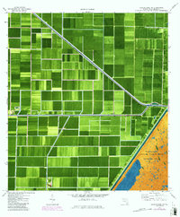
1970 Map of Loxahatchee NW
USGS Topo · Published 1984About this map
Hydrological engineering and large-scale agriculture dominate this portion of Palm Beach County, where the West Palm Beach Canal serves as a primary artery through the reclaimed Everglades. The landscape is defined by a rigid grid of agricultural fields, punctuated by numerous pumps and smaller waterways like the Ocean Canal and L-7 Canal. These systems manage the water table to sustain the intensive farming operations characteristic of this region in the early 1980s.
Find a feature on this map
7 named features on this map. Tap any name to fly to it.
Don’t see what you’re looking for? This feature index may not catch every label — zoom into the map to look around manually.
Map Details
Editions of this 1970 Loxahatchee NW Map
2 editions found
Other maps of this area

1956 · West Palm Beach
USGS Topo · 1:250,000

1957 · West Palm Beach
USGS Topo · 1:250,000

1958 · West Palm Beach
USGS Topo · 1:250,000

1970 · West Palm Beach 2 SW
USGS Topo · 1:24,000
1970 · Loxahatchee SE
USGS Topo · 1:24,000

1970 · Loxahatchee NW
USGS Topo · 1:24,000

1970 · Loxahatchee SW
USGS Topo · 1:24,000

1970 · Shawano
USGS Topo · 1:24,000

1970 · Bryant
USGS Topo · 1:24,000

1970 · Sixmile Bend
USGS Topo · 1:24,000