
1970 Map of West Palm Beach 2 SW
USGS Topo · Published 1976About this map
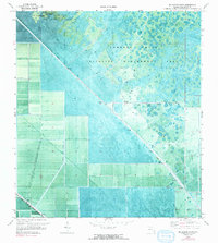
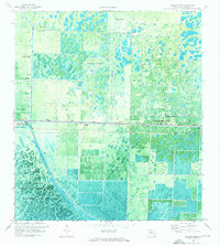
Corbett State Wildlife Management Area dominates the eastern half of this landscape, showcasing a complex mosaic of Florida wetlands and cypress strands as they appeared in 1970. The transition from these preserved wetlands to a strictly gridded agricultural and water management system is starkly visible. This engineered environment is defined by significant waterways including the West Palm Beach Canal and the L-8 Canal, which run alongside the Big Mound Canal to regulate the flow across the flat terrain. Evidence of localized infrastructure is sparse but notable, featuring a Landing Strip near the prominent elevation of Big Mound and several Pump stations situated at critical junctions. This orthophotomap provides a rare hybrid view, combining traditional topographic linework with actual aerial photography to reveal the fine-grained patterns of land use and drainage that shaped Palm Beach County during this era.
Find a feature on this map
11 named features on this map. Tap any name to fly to it.
Don’t see what you’re looking for? This feature index may not catch every label — zoom into the map to look around manually.
Map Details
Editions of this 1970 West Palm Beach 2 SW Map
2 editions found
Other maps of this area

1956 · West Palm Beach
USGS Topo · 1:250,000

1957 · West Palm Beach
USGS Topo · 1:250,000

1958 · West Palm Beach
USGS Topo · 1:250,000

1970 · Loxahatchee NW
USGS Topo · 1:24,000
1970 · West Palm Beach 2 NE
USGS Topo · 1:24,000

1970 · Bryant
USGS Topo · 1:24,000

1970 · Sixmile Bend
USGS Topo · 1:24,000
1970 · West Palm Beach 2 NW
USGS Topo · 1:24,000
1971 · West Palm Beach 2 SE
USGS Topo · 1:24,000
1971 · Loxahatchee
USGS Topo · 1:24,000