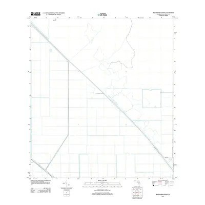
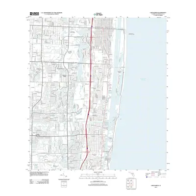
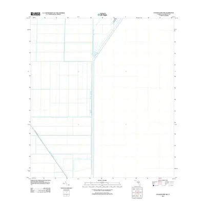
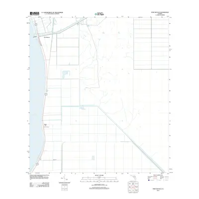
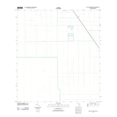
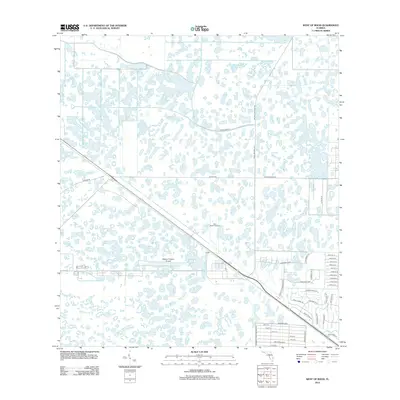
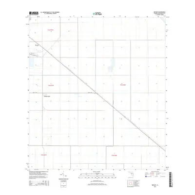
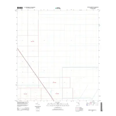
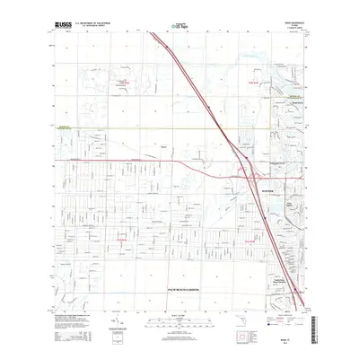
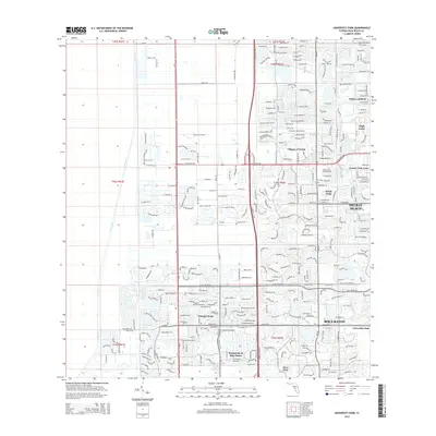
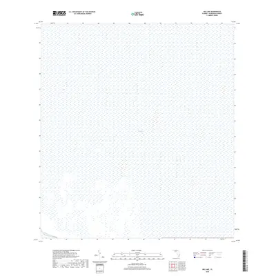
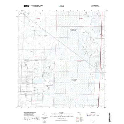
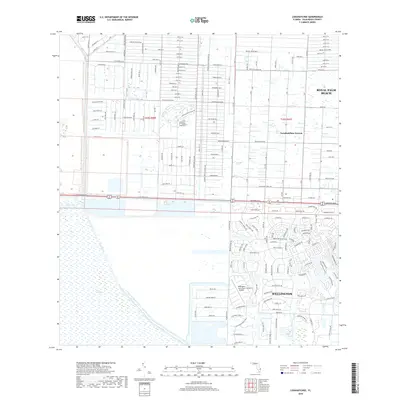
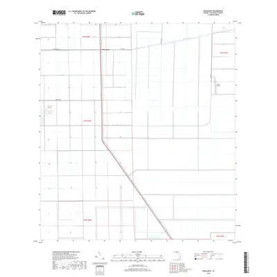
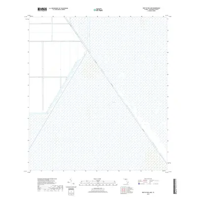
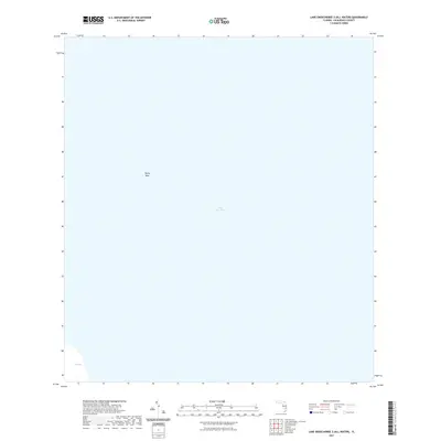
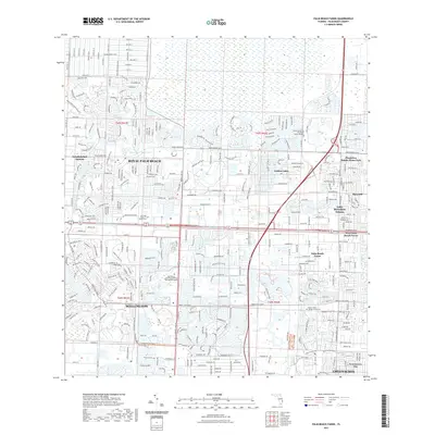
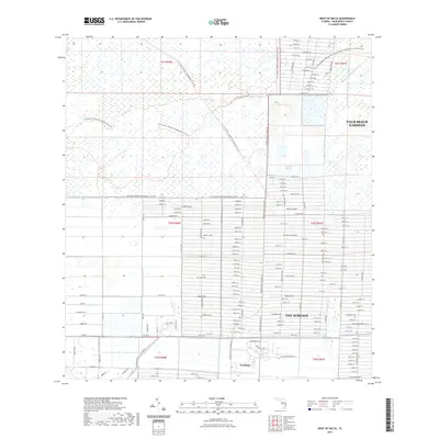
1971 Map of West Palm Beach 2 SE
USGS Topo · Published 1976About this map
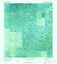
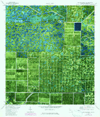
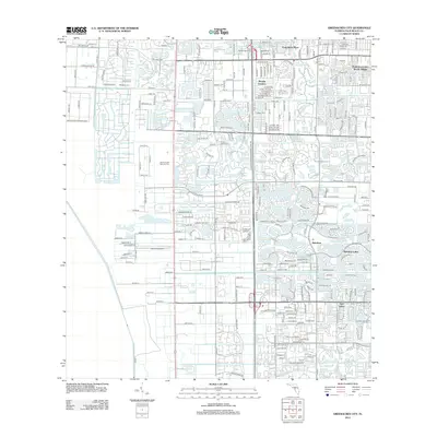
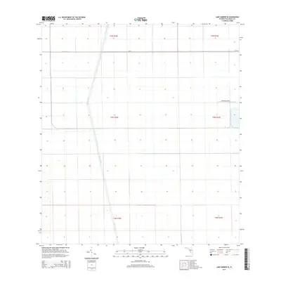
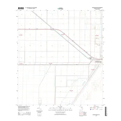
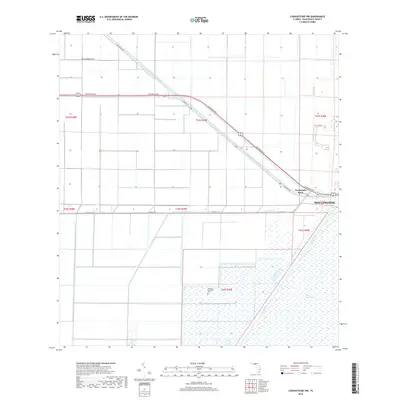
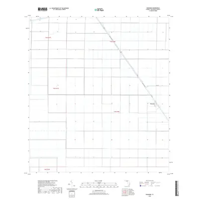
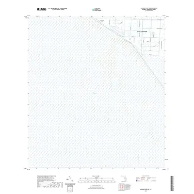
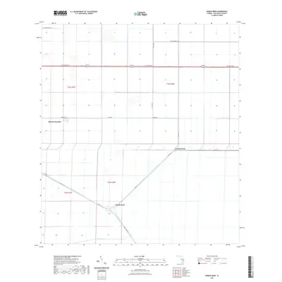
Corbett State Wildlife Management Area dominates this landscape, showing a dense mosaic of wetland and upland habitats in the early 1970s. The orthophotomap format provides an unfiltered look at the complex hydrology of the region, where the natural Slough and the marshy expanse of Hungryland contrast with the rigid geometry of the drainage system. Large-scale water management is evidenced by the prominent L-8 Canal and additional Canal routes designed to move water across the flat terrain. Human infrastructure is sparse but specific, including a Landing Strip, several Pumps, and the South Florida Youth Conservation Camp. The presence of Seminole Road and various land lines established by private survey indicate the ongoing efforts to reconcile conservation with the growing needs of Palm Beach County.
Find a feature on this map
10 named features on this map. Tap any name to fly to it.
Don’t see what you’re looking for? This feature index may not catch every label — zoom into the map to look around manually.
Map Details
Editions of this 1971 West Palm Beach 2 SE Map
3 editions found
Historical Maps of Palm Beach County Through Time
170 maps found

1945 Delta
Palm Beach County, FL

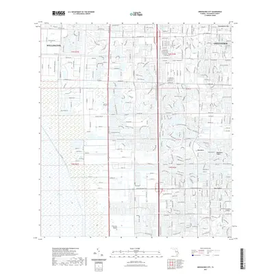
1945 Greenacres City
Palm Beach County, FL

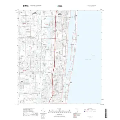
1945 Lake Worth
Palm Beach County, FL

1946 Palm Beach Farms
Palm Beach County, FL

1947 Delmar Farms
Palm Beach County, FL

1948 Rood
Palm Beach County, FL

1949 Delmar Farms
Palm Beach County, FL

1949 Lake Worth
Palm Beach County, FL

1949 Palm Beach Farms
Palm Beach County, FL

1949 Rood
Palm Beach County, FL

1950 Delta
Palm Beach County, FL

1950 Greenacres City
Palm Beach County, FL

1962 University Park
Palm Beach County, FL

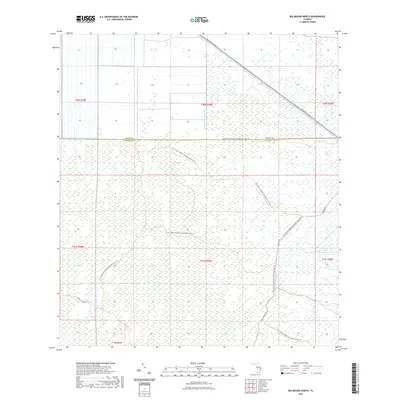
1970 Big Mound North
Palm Beach County, FL

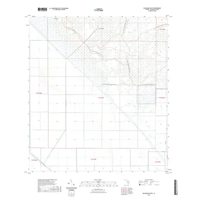
1970 Big Mound South
Palm Beach County, FL

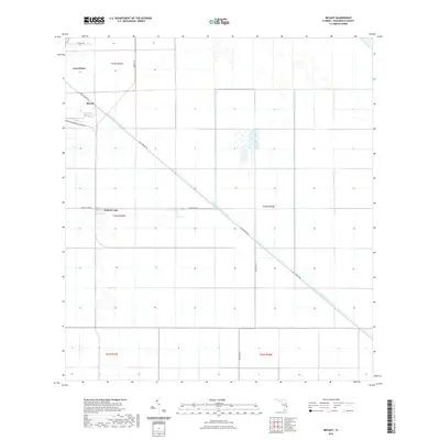
1970 Bryant
Palm Beach County, FL

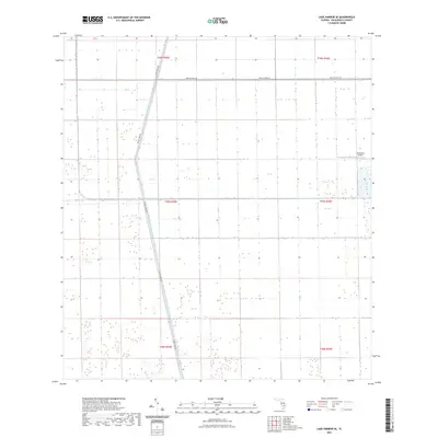
1970 Lake Harbor SE
Palm Beach County, FL

1970 Loxahatchee NW
Palm Beach County, FL

1970 Loxahatchee SE
Palm Beach County, FL

1970 Loxahatchee SW
Palm Beach County, FL

1970 Okeelanta
Palm Beach County, FL

1970 Shawano
Palm Beach County, FL

1970 Sixmile Bend
Palm Beach County, FL

1970 West Of Rood
Palm Beach County, FL

1971 Loxahatchee
Palm Beach County, FL

1971 Port Mayaca
Palm Beach County, FL

1971 West Of Delta
Palm Beach County, FL

1971 West Palm Beach 2 SW
Palm Beach County, FL

1973 Big Lake
Palm Beach County, FL

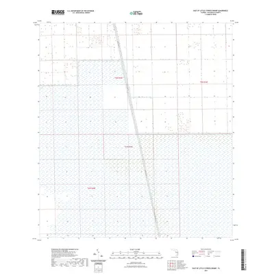
1974 East of Little Cypress Swamp
Palm Beach County, FL

1974 North Of Deem City
Palm Beach County, FL

1974 South Of Okeelanta
Palm Beach County, FL

1974 West Of Big Lake
Palm Beach County, FL

1979 Loxahatchee
Palm Beach County, FL

1994 West Of Rood
Palm Beach County, FL
2012 Big Lake
Palm Beach County, FL
2012 Big Mound North
Palm Beach County, FL
2012 Big Mound South
Palm Beach County, FL
2012 Bryant
Palm Beach County, FL
2012 Delta
Palm Beach County, FL
2012 East of Little Cypress Swamp
Palm Beach County, FL
2012 Greenacres City
Palm Beach County, FL
2012 Lake Harbor SE
Palm Beach County, FL
2012 Lake Okeechobee 1 (All Water)
Palm Beach County, FL
2012 Lake Okeechobee 2 (All Water)
Palm Beach County, FL
2012 Lake Worth
Palm Beach County, FL
2012 Loxahatchee NW
Palm Beach County, FL
2012 Loxahatchee
Palm Beach County, FL
2012 Loxahatchee SE
Palm Beach County, FL
2012 Loxahatchee SW
Palm Beach County, FL
2012 North of Deem City
Palm Beach County, FL
2012 Okeelanta
Palm Beach County, FL
2012 Palm Beach Farms
Palm Beach County, FL
2012 Port Mayaca
Palm Beach County, FL
2012 Rood
Palm Beach County, FL
2012 Shawano
Palm Beach County, FL
2012 Sixmile Bend
Palm Beach County, FL
2012 South of Okeelanta
Palm Beach County, FL
2012 University Park
Palm Beach County, FL
2012 West of Big Lake
Palm Beach County, FL
2012 West of Delta
Palm Beach County, FL
2012 West of Rood
Palm Beach County, FL
2015 Big Lake
Palm Beach County, FL
2015 Big Mound North
Palm Beach County, FL
2015 Big Mound South
Palm Beach County, FL
2015 Bryant
Palm Beach County, FL
2015 Delta
Palm Beach County, FL
2015 East of Little Cypress Swamp
Palm Beach County, FL
2015 Greenacres City
Palm Beach County, FL
2015 Lake Harbor SE
Palm Beach County, FL
2015 Lake Okeechobee 1 (All Water)
Palm Beach County, FL
2015 Lake Okeechobee 2 (All Water)
Palm Beach County, FL
2015 Lake Worth
Palm Beach County, FL
2015 Loxahatchee NW
Palm Beach County, FL
2015 Loxahatchee
Palm Beach County, FL
2015 Loxahatchee SE
Palm Beach County, FL
2015 Loxahatchee SW
Palm Beach County, FL
2015 North of Deem City
Palm Beach County, FL
2015 Okeelanta
Palm Beach County, FL
2015 Palm Beach Farms
Palm Beach County, FL
2015 Port Mayaca
Palm Beach County, FL
2015 Rood
Palm Beach County, FL
2015 Shawano
Palm Beach County, FL
2015 Sixmile Bend
Palm Beach County, FL
2015 South of Okeelanta
Palm Beach County, FL
2015 University Park
Palm Beach County, FL
2015 West of Big Lake
Palm Beach County, FL
2015 West of Delta
Palm Beach County, FL
2015 West of Rood
Palm Beach County, FL
2018 Big Lake
Palm Beach County, FL
2018 Big Mound North
Palm Beach County, FL
2018 Big Mound South
Palm Beach County, FL
2018 Bryant
Palm Beach County, FL
2018 Delta
Palm Beach County, FL
2018 East of Little Cypress Swamp
Palm Beach County, FL
2018 Greenacres City
Palm Beach County, FL
2018 Lake Harbor SE
Palm Beach County, FL
2018 Lake Okeechobee 1 (All Water)
Palm Beach County, FL
2018 Lake Okeechobee 2 (All Water)
Palm Beach County, FL
2018 Lake Worth
Palm Beach County, FL
2018 Loxahatchee NW
Palm Beach County, FL
2018 Loxahatchee
Palm Beach County, FL
2018 Loxahatchee SE
Palm Beach County, FL
2018 Loxahatchee SW
Palm Beach County, FL
2018 North of Deem City
Palm Beach County, FL
2018 Okeelanta
Palm Beach County, FL
2018 Palm Beach Farms
Palm Beach County, FL
2018 Port Mayaca
Palm Beach County, FL
2018 Rood
Palm Beach County, FL
2018 Shawano
Palm Beach County, FL
2018 Sixmile Bend
Palm Beach County, FL
2018 South of Okeelanta
Palm Beach County, FL
2018 University Park
Palm Beach County, FL
2018 West of Big Lake
Palm Beach County, FL
2018 West of Delta
Palm Beach County, FL
2018 West of Rood
Palm Beach County, FL
2021 Big Lake
Palm Beach County, FL
2021 Big Mound North
Palm Beach County, FL
2021 Big Mound South
Palm Beach County, FL
2021 Bryant
Palm Beach County, FL
2021 Delta
Palm Beach County, FL
2021 East of Little Cypress Swamp
Palm Beach County, FL
2021 Greenacres City
Palm Beach County, FL
2021 Lake Harbor SE
Palm Beach County, FL
2021 Lake Okeechobee 1 (All Water)
Palm Beach County, FL
2021 Lake Okeechobee 2 (All Water)
Palm Beach County, FL
2021 Lake Worth
Palm Beach County, FL
2021 Loxahatchee NW
Palm Beach County, FL
2021 Loxahatchee
Palm Beach County, FL
2021 Loxahatchee SE
Palm Beach County, FL
2021 Loxahatchee SW
Palm Beach County, FL
2021 North of Deem City
Palm Beach County, FL
2021 Okeelanta
Palm Beach County, FL
2021 Palm Beach Farms
Palm Beach County, FL
2021 Port Mayaca
Palm Beach County, FL
2021 Rood
Palm Beach County, FL
2021 Shawano
Palm Beach County, FL
2021 Sixmile Bend
Palm Beach County, FL
2021 South of Okeelanta
Palm Beach County, FL
2021 University Park
Palm Beach County, FL
2021 West of Big Lake
Palm Beach County, FL
2021 West of Delta
Palm Beach County, FL
2021 West of Rood
Palm Beach County, FL

2024 Big Lake
Palm Beach County, FL

2024 Big Mound North
Palm Beach County, FL

2024 Big Mound South
Palm Beach County, FL

2024 Bryant
Palm Beach County, FL

2024 Delta
Palm Beach County, FL

2024 East of Little Cypress Swamp
Palm Beach County, FL

2024 Greenacres City
Palm Beach County, FL

2024 Lake Harbor SE
Palm Beach County, FL

2024 Lake Okeechobee 1 (All Water)
Palm Beach County, FL

2024 Lake Okeechobee 2 (All Water)
Palm Beach County, FL

2024 Lake Worth
Palm Beach County, FL

2024 Loxahatchee NW
Palm Beach County, FL

2024 Loxahatchee
Palm Beach County, FL

2024 Loxahatchee SE
Palm Beach County, FL

2024 Loxahatchee SW
Palm Beach County, FL

2024 North of Deem City
Palm Beach County, FL

2024 Okeelanta
Palm Beach County, FL

2024 Palm Beach Farms
Palm Beach County, FL

2024 Port Mayaca
Palm Beach County, FL

2024 Rood
Palm Beach County, FL

2024 Shawano
Palm Beach County, FL

2024 Sixmile Bend
Palm Beach County, FL

2024 South of Okeelanta
Palm Beach County, FL

2024 University Park
Palm Beach County, FL

2024 West of Big Lake
Palm Beach County, FL

2024 West of Delta
Palm Beach County, FL

2024 West of Rood
Palm Beach County, FL