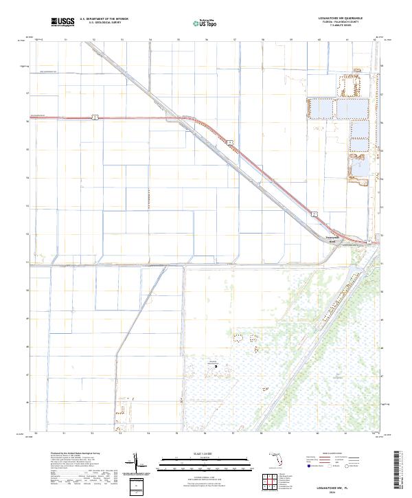
2024 Map of Loxahatchee NW
USGS Topo · Published 2024About this map
Twentymile Bend serves as a critical junction where the northern reaches of The Everglades meet the engineering of the Florida drainage system. This area is defined by the intersection of major arterial waterways, including the West Palm Beach Canal and the L-7 Canal, which carve through the low-lying terrain to manage water levels across Palm Beach County. The landscape is a mix of agricultural utility and preserved wilderness, anchored by the sprawling Arthur R Marshall Loxahatchee National Wildlife Refuge. Historical transportation routes like Old Conners Rd and Connors Hwy parallel the canals, reflecting the mid-century infrastructure required to navigate and settle this marshy interior. To the south, the Riverside Memorial Park provides a notable landmark amidst the wetland and canal grid, while the 20 Mile Bend Boat Ramp Rd provides access to the region's prominent aquatic corridors.
Find a feature on this map
18 named features on this map. Tap any name to fly to it.
Don’t see what you’re looking for? This feature index may not catch every label — zoom into the map to look around manually.
Map Details
Editions of this 2024 Loxahatchee NW Map
This is the sole edition of this map. No revisions or reprints were ever made.
Other maps of this area

1956 · West Palm Beach
USGS Topo · 1:250,000

1957 · West Palm Beach
USGS Topo · 1:250,000

1958 · West Palm Beach
USGS Topo · 1:250,000

1970 · West Palm Beach 2 SW
USGS Topo · 1:24,000
1970 · Loxahatchee SE
USGS Topo · 1:24,000

1970 · Loxahatchee NW
USGS Topo · 1:24,000

1970 · Loxahatchee SW
USGS Topo · 1:24,000

1970 · Shawano
USGS Topo · 1:24,000

1970 · Bryant
USGS Topo · 1:24,000

1970 · Sixmile Bend
USGS Topo · 1:24,000