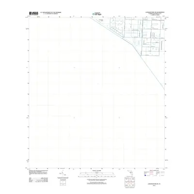
2012 Map of Loxahatchee SE
USGS Topo · Published 2012About this map
Loxahatchee Airport and the surrounding equestrian estates of western Palm Beach County define this landscape during the early 21st century. The map illustrates a transitional zone where the structured grid of development meets the vast conservation areas of the Everglades. The most prominent hydrological feature is the L-40 Canal, which serves as a definitive boundary between the burgeoning residential communities and the natural wetlands to the west. Roads such as Stables Way and Palm Beach Point Blvd reflect the area's distinct local industry and land use patterns focused on horse farms and large residential tracts. This survey captures the layout of the region just as the Wellington Preserve Blvd area was being formalized, providing a clear view of the roadway network including Indian Mound Rd and Rainbow RD before further modern suburban expansion.
Find a feature on this map
23 named features on this map. Tap any name to fly to it.
Don’t see what you’re looking for? This feature index may not catch every label — zoom into the map to look around manually.
Map Details
Editions of this 2012 Loxahatchee SE Map
This is the sole edition of this map. No revisions or reprints were ever made.
Other maps of this area

1945 · Greenacres City
USGS Topo · 1:24,000

1946 · Palm Beach Farms
USGS Topo · 1:24,000

1947 · Delmar Farms
USGS Topo · 1:24,000

1949 · Palm Beach Farms
USGS Topo · 1:24,000

1949 · Delmar Farms
USGS Topo · 1:24,000

1950 · Greenacres City
USGS Topo · 1:24,000

1956 · West Palm Beach
USGS Topo · 1:250,000

1957 · West Palm Beach
USGS Topo · 1:250,000

1958 · West Palm Beach
USGS Topo · 1:250,000
1962 · University Park
USGS Topo · 1:24,000