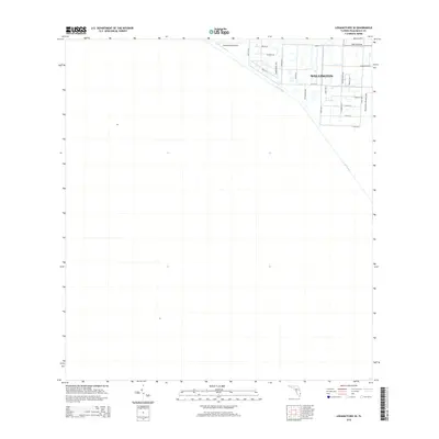
2015 Map of Loxahatchee SE
USGS Topo · Published 2015About this map
Wellington anchors the northeast corner of this 2015 survey, representing a suburban landscape defined by its grid of residential streets and canals. The area transitions from the organized development of neighborhoods along Lake Worth Rd and Indianmound Rd toward the managed wetlands and conservation areas to the south and west. The L-40 Canal creates a sharp diagonal boundary, separating the developed village from the open expanses of the northern Everglades.
Find a feature on this map
26 named features on this map. Tap any name to fly to it.
Don’t see what you’re looking for? This feature index may not catch every label — zoom into the map to look around manually.
Map Details
Editions of this 2015 Loxahatchee SE Map
This is the sole edition of this map. No revisions or reprints were ever made.
Other maps of this area

1945 · Greenacres City
USGS Topo · 1:24,000

1946 · Palm Beach Farms
USGS Topo · 1:24,000

1947 · Delmar Farms
USGS Topo · 1:24,000

1949 · Palm Beach Farms
USGS Topo · 1:24,000

1949 · Delmar Farms
USGS Topo · 1:24,000

1950 · Greenacres City
USGS Topo · 1:24,000

1956 · West Palm Beach
USGS Topo · 1:250,000

1957 · West Palm Beach
USGS Topo · 1:250,000

1958 · West Palm Beach
USGS Topo · 1:250,000
1962 · University Park
USGS Topo · 1:24,000