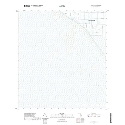
2021 Map of Loxahatchee SE
USGS Topo · Published 2021About this map
The Everglades dominate the western landscape of this Palm Beach County region, appearing as a vast wetland expanse defined by the L-40 Canal that separates the wild marsh from the residential and equestrian developments of Wellington. This boundary illustrates the sharp transition between the protected Florida wilderness and the structured grid of the eastern settlements. The community layout in the northeast reflects its unique character, with street names like Stables Way, Flying Cow Rd, and Palm Beach Point Blvd hinting at the area's specialized land use. Near the northern edge, the Loxahatchee Airport and Indian Mound Rd provide local landmarks amidst the transition from preserved natural space to suburban expansion.
Find a feature on this map
28 named features on this map. Tap any name to fly to it.
Don’t see what you’re looking for? This feature index may not catch every label — zoom into the map to look around manually.
Map Details
Editions of this 2021 Loxahatchee SE Map
This is the sole edition of this map. No revisions or reprints were ever made.
Other maps of this area

1945 · Greenacres City
USGS Topo · 1:24,000

1946 · Palm Beach Farms
USGS Topo · 1:24,000

1947 · Delmar Farms
USGS Topo · 1:24,000

1949 · Palm Beach Farms
USGS Topo · 1:24,000

1949 · Delmar Farms
USGS Topo · 1:24,000

1950 · Greenacres City
USGS Topo · 1:24,000

1956 · West Palm Beach
USGS Topo · 1:250,000

1957 · West Palm Beach
USGS Topo · 1:250,000

1958 · West Palm Beach
USGS Topo · 1:250,000
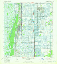
1962 · University Park
USGS Topo · 1:24,000