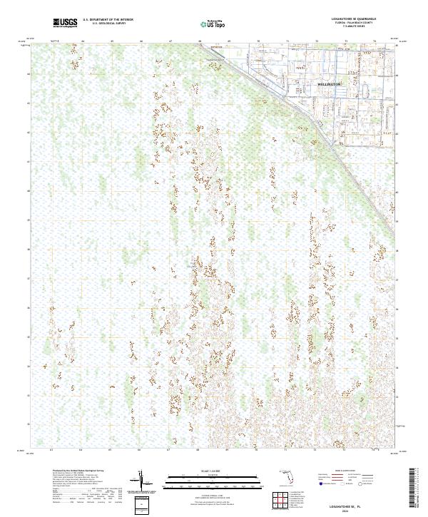
2024 Map of Loxahatchee SE
USGS Topo · Published 2024About this map
Wellington marks the transition between suburban development and the protected conservation lands of the Florida interior. The northeast portion of this sheet reveals an intricate grid of residential roads and equestrian-themed corridors like Palm Beach Point Blvd and S Shore Blvd, which abruptly meet the engineered barrier of the L-40 Canal. West of this divide, the landscape shifts entirely to the undisturbed expanse of The Everglades and the Arthur R Marshall Loxahatchee National Wildlife Refuge.
Find a feature on this map
30 named features on this map. Tap any name to fly to it.
Don’t see what you’re looking for? This feature index may not catch every label — zoom into the map to look around manually.
Map Details
Editions of this 2024 Loxahatchee SE Map
This is the sole edition of this map. No revisions or reprints were ever made.
Other maps of this area

1945 · Greenacres City
USGS Topo · 1:24,000

1946 · Palm Beach Farms
USGS Topo · 1:24,000

1947 · Delmar Farms
USGS Topo · 1:24,000

1949 · Palm Beach Farms
USGS Topo · 1:24,000

1949 · Delmar Farms
USGS Topo · 1:24,000

1950 · Greenacres City
USGS Topo · 1:24,000

1956 · West Palm Beach
USGS Topo · 1:250,000

1957 · West Palm Beach
USGS Topo · 1:250,000

1958 · West Palm Beach
USGS Topo · 1:250,000
1962 · University Park
USGS Topo · 1:24,000