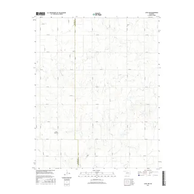
2016 Map of Loyal NW
USGS Topo · Published 2016About this map
Kingfisher County and Blaine County meet along a stark north-south boundary line on this agricultural stretch of the Oklahoma prairie. The landscape is defined by the winding paths of Otter Cr and Cooper Cr, which carve through a grid of rural section roads. This particular area serves as a focal point for local genealogy, containing several distinct burial sites including Lorenz Cem and Venable Cem in the northern half. Further south, the community identity is anchored by the Omega Cem and the Omega Seventh Day Adventist Cem, reflecting the early religious and family-based settlement patterns of this plains region. The map captures the enduring persistence of the rural grid, where numbered roads like e0730 RD and n2690 RD link isolated farmsteads across the undulating terrain.
Find a feature on this map
28 named features on this map. Tap any name to fly to it.
Don’t see what you’re looking for? This feature index may not catch every label — zoom into the map to look around manually.
Map Details
Editions of this 2016 Loyal NW Map
This is the sole edition of this map. No revisions or reprints were ever made.
Other maps of this area
1893 · Loyal
USGS Topo · 1:62,500
1893 · Ames
USGS Topo · 1:62,500
1955 · Clinton
USGS Topo · 1:250,000
1955 · Woodward
USGS Topo · 1:250,000
1956 · Ames
USGS Topo · 1:62,500
1957 · Clinton
USGS Topo · 1:250,000
1958 · Woodward
USGS Topo · 1:250,000
1972 · Loyal SE
USGS Topo · 1:24,000
1972 · Omega
USGS Topo · 1:24,000
1972 · Watonga SE
USGS Topo · 1:24,000