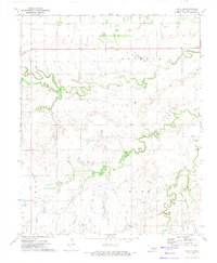
1972 Map of Loyal SE
USGS Topo · Published 1974About this map
The small community of Alpha sits in the northern reaches of this Kingfisher County landscape, which is defined by the winding course of Kingfisher Creek and the extensive Oil Field operations that dot the plains. Recorded in the early 1970s, the map reveals a rural economy centered on resource extraction and agriculture, evidenced by numerous scattered Oil Well and Gas Well locations alongside a substantial Feed Lot. Genealogists may find particular interest in the Indian Cem and Mt Pisgah Cem, which preserve early settlement history near the drainage of Dead Indian Creek. The sprawling Omega Reserve Park occupies a significant portion of the western territory, while a network of pipelines and gravel extraction sites, including various Gravel Pits, underscore the industrial activity occurring during this era.
Find a feature on this map
16 named features on this map. Tap any name to fly to it.
Don’t see what you’re looking for? This feature index may not catch every label — zoom into the map to look around manually.
Map Details
Editions of this 1972 Loyal SE Map
This is the sole edition of this map. No revisions or reprints were ever made.
Other maps of this area

1892 · Kingfisher
USGS Topo · 1:125,000

1893 · Fort Reno
USGS Topo · 1:62,500

1893 · Loyal
USGS Topo · 1:62,500

1895 · Kingfisher
USGS Topo · 1:125,000

1941 · Fort Reno
USGS Topo · 1:62,500

1942 · Fort Reno
USGS Topo · 1:62,500

1949 · Fort Reno
USGS Topo · 1:62,500

1954 · Oklahoma City
USGS Topo · 1:250,000

1955 · Clinton
USGS Topo · 1:250,000

1957 · Clinton
USGS Topo · 1:250,000