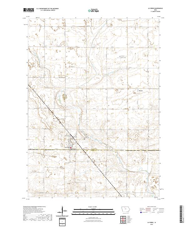
2022 Map of Lu Verne
USGS Topo · Published 2022About this map
Lu Verne straddles the boundary of Kossuth Co Humboldt Co, serving as a central point for this agricultural region in the early 2020s. The landscape is defined by its rectilinear grid of county roads and an extensive network of managed waterways, including Drainage Ditch Number 103 and Drainage Ditch Number 116, which support the intensive prairie farming surrounding the town. Local history is anchored at the Lu Verne Cem north of the town center and at the settlement of Hanna to the northeast.
Find a feature on this map
33 named features on this map. Tap any name to fly to it.
Don’t see what you’re looking for? This feature index may not catch every label — zoom into the map to look around manually.
Map Details
Editions of this 2022 Lu Verne Map
This is the sole edition of this map. No revisions or reprints were ever made.
Other maps of this area

1954 · Fairmont
USGS Topo · 1:250,000

1954 · Mason City
USGS Topo · 1:250,000

1954 · Waterloo
USGS Topo · 1:250,000

1954 · Fort Dodge
USGS Topo · 1:250,000

1955 · Waterloo
USGS Topo · 1:250,000

1957 · Fort Dodge
USGS Topo · 1:250,000

1957 · Mason City
USGS Topo · 1:250,000

1958 · Mason City
USGS Topo · 1:250,000

1958 · Fort Dodge
USGS Topo · 1:250,000

1958 · Fairmont
USGS Topo · 1:250,000