
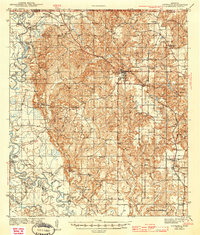
1943 Map of Lucedale
USGS Topo · Published 1943About this map
The confluence of the Chickasawhay River and the Leaf River defines the western landscape of this 1941 survey, forming the headwaters of the Pascagoula River. Along these watercourses, a complex system of cutoffs and oxbows like Plum Bluff Cutoff and Bilbo Dead River illustrates the shifting nature of the southern Mississippi river plains. The town of Lucedale serves as the regional hub, situated at the junction of the Gulf Mobile and Ohio and the Mississippi Export railroads.
Find a feature on this map
77 named features on this map. Tap any name to fly to it.
Don’t see what you’re looking for? This feature index may not catch every label — zoom into the map to look around manually.
Map Details
Editions of this 1943 Lucedale Map
2 editions found
Other maps of this area

1941 · Hurley
USGS Topo · 1:62,500

1941 · Vancleave
USGS Topo · 1:62,500

1941 · Lucedale
USGS Topo · 1:62,500

1942 · Deer Park
USGS Topo · 1:62,500

1942 · Wilmer
USGS Topo · 1:62,500

1943 · Deer Park
USGS Topo · 1:62,500

1943 · Hurley
USGS Topo · 1:62,500

1943 · Vancleave
USGS Topo · 1:62,500

1944 · Wilmer
USGS Topo · 1:62,500

1944 · Vancleave
USGS Topo · 1:62,500