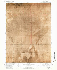
1983 Map of Lucin 4 SE
USGS Topo · Published 1983About this map
Air Force Range lands dominate the southern expanse of this 1983 orthophotomap, where the boundary between Box Elder Co and Tooele Co cuts across a stark, remote desert landscape. The terrain is characterized by an extensive Mud Flat, a featureless plain punctuated only by a solitary Hill in the southern quadrant. This survey, compiled from 1973 aerial photography, captures the isolation of the Great Salt Lake Desert, where the primary human footprint is defined by military use rather than settlement. The lack of roads, structures, or traditional landmarks emphasizes the specialized utility of this corridor for defense testing during the late twentieth century.
Find a feature on this map
4 named features on this map. Tap any name to fly to it.
Don’t see what you’re looking for? This feature index may not catch every label — zoom into the map to look around manually.
Map Details
Editions of this 1983 Lucin 4 SE Map
This is the sole edition of this map. No revisions or reprints were ever made.
Other maps of this area

1953 · Tooele
USGS Topo · 1:250,000

1954 · Brigham City
USGS Topo · 1:250,000

1955 · Tooele
USGS Topo · 1:250,000

1958 · Brigham City
USGS Topo · 1:250,000

1962 · Brigham City
USGS Topo · 1:250,000

1973 · Knolls 2 NW
USGS Topo · 1:24,000

1973 · Floating Island NE
USGS Topo · 1:24,000
1973 · Floating Island
USGS Topo · 1:24,000
1979 · Bonneville Salt Flats
USGS Topo · 1:100,000
1983 · Lucin 4 SW
USGS Topo · 1:24,000