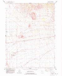
1991 Map of Lucin NE
USGS Topo · Published 1992About this map
The Grouse Creek Mountains dominate the northern portion of this arid landscape in Box Elder County, showing a complex network of 4WD trails traversing the high desert terrain. Water management is central to the human footprint here, as evidenced by the infrastructure at Rabbit Spring Reservoir and the presence of an Aqueduct and Water Tank in the western reaches. The distribution of natural water sources like Owl Spring, Rabbit Spring, and East Rabbit Spring suggests a reliance on these critical points for livestock or local industry in a region otherwise defined by its sparse vegetation and alluvial fans. Industrial activity is localized at a Borrow Pit and Gravel Pit, pointing toward road maintenance and material extraction in this part of the Great Basin during the early 1990s.
Find a feature on this map
10 named features on this map. Tap any name to fly to it.
Don’t see what you’re looking for? This feature index may not catch every label — zoom into the map to look around manually.
Map Details
Editions of this 1991 Lucin NE Map
This is the sole edition of this map. No revisions or reprints were ever made.
Other maps of this area

1954 · Brigham City
USGS Topo · 1:250,000

1958 · Brigham City
USGS Topo · 1:250,000

1962 · Brigham City
USGS Topo · 1:250,000

1967 · Pigeon Mountain
USGS Topo · 1:24,000

1967 · Lucin
USGS Topo · 1:24,000
1967 · Lucin NW
USGS Topo · 1:24,000

1967 · Lucin NE
USGS Topo · 1:24,000

1971 · Emigrant Pass
USGS Topo · 1:24,000
1971 · Toms Cabin Spring
USGS Topo · 1:24,000
1971 · Rocky Pass Peak
USGS Topo · 1:24,000