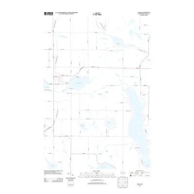
2013 Map of Luck
USGS Topo · Published 2013About this map
Big Butternut Lake serves as a central landmark for this northwestern Wisconsin landscape, where the village street grid meets the water at W Butternut Ave and E Park Ave. The area is defined by a dense network of glacial water bodies, from the sprawling Bone Lake in the southeast to the smaller Murdock Lake and Mallard Lake. This 2013 survey illustrates the modern recreational and residential character of the region, anchored by protected lands and seasonal corridors.
Find a feature on this map
52 named features on this map. Tap any name to fly to it.
Don’t see what you’re looking for? This feature index may not catch every label — zoom into the map to look around manually.
Map Details
Editions of this 2013 Luck Map
This is the sole edition of this map. No revisions or reprints were ever made.
Other maps of this area

1900 · St Croix Dalles
USGS Topo · 1:62,500

1901 · St Croix Dalles
USGS Topo · 1:62,500

1950 · Balsam Lake
USGS Topo · 1:62,500

1951 · Milltown
USGS Topo · 1:48,000

1951 · Frederic
USGS Topo · 1:48,000

1953 · Stillwater
USGS Topo · 1:250,000

1955 · St. Croix Dalles
USGS Topo · 1:62,500

1955 · Frederic
USGS Topo · 1:62,500

1955 · Milltown
USGS Topo · 1:62,500

1955 · Stillwater
USGS Topo · 1:250,000