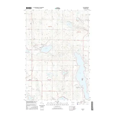
2015 Map of Luck
USGS Topo · Published 2015About this map
Luck and Milltown anchor this Polk County landscape, which is defined by a dense network of glacial lakes and wetlands. The village of Luck sits between the shores of Big Butternut Lake and Little Butternut Lake, while the Ice Age National Scenic Trail winds through the northern and western sections of the quadrangle. This trail alignment follows the glacial topography, passing near Saint Peters Cem and tracing the drainage of the S Br Trade River.
Find a feature on this map
83 named features on this map. Tap any name to fly to it.
Don’t see what you’re looking for? This feature index may not catch every label — zoom into the map to look around manually.
Map Details
Editions of this 2015 Luck Map
This is the sole edition of this map. No revisions or reprints were ever made.
Other maps of this area

1900 · St Croix Dalles
USGS Topo · 1:62,500

1901 · St Croix Dalles
USGS Topo · 1:62,500

1950 · Balsam Lake
USGS Topo · 1:62,500

1951 · Milltown
USGS Topo · 1:48,000

1951 · Frederic
USGS Topo · 1:48,000

1953 · Stillwater
USGS Topo · 1:250,000

1955 · St. Croix Dalles
USGS Topo · 1:62,500

1955 · Frederic
USGS Topo · 1:62,500

1955 · Milltown
USGS Topo · 1:62,500

1955 · Stillwater
USGS Topo · 1:250,000