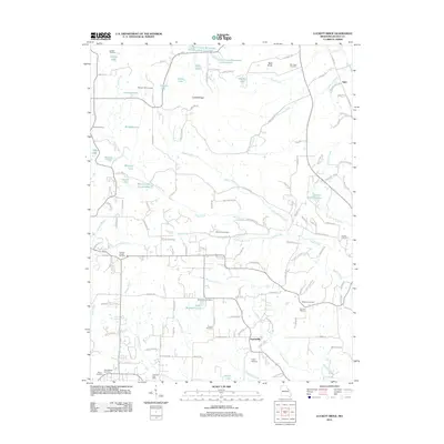
2011 Map of Luckett Ridge
USGS Topo · Published 2011About this map
Luckett Ridge and Bald Knob anchor this 2011 Missouri landscape, where the rural character of Lincoln County is defined by a dense network of family-named cemeteries and small water bodies. The settlement of Argentville and the Chantilla Post Office serve as local landmarks alongside numerous small impoundments like Ross Mulvehill Lake and Glosier Lake. This era shows a community structured around its spiritual and educational roots, evidenced by the presence of Ashbury Chapel, the Cornick School, and over a dozen burial grounds including New Salem Cemetery and Pleasant Hill Cemetery. The complex drainage patterns of Upper Sandy Creek and McLean Creek intersect with modern infrastructure, such as the Lost Creek Watershed Structure E-7 Lake, reflecting mid-to-late 20th-century water management efforts across this agricultural terrain.
Find a feature on this map
130 named features on this map. Tap any name to fly to it.
Don’t see what you’re looking for? This feature index may not catch every label — zoom into the map to look around manually.
Map Details
Editions of this 2011 Luckett Ridge Map
This is the sole edition of this map. No revisions or reprints were ever made.
Other maps of this area

1903 · O'Fallon
USGS Topo · 1:125,000

1930 · Hardin
USGS Topo · 1:62,500

1931 · Brussels
USGS Topo · 1:62,500

1934 · Elsberry
USGS Topo · 1:48,000

1934 · Hardin
USGS Topo · 1:62,500

1938 · Hardin
USGS Topo · 1:62,500

1939 · Brussels
USGS Topo · 1:62,500

1941 · Troy
USGS Topo · 1:62,500

1942 · Elsberry
USGS Topo · 1:62,500

1943 · Brussels
USGS Topo · 1:62,500