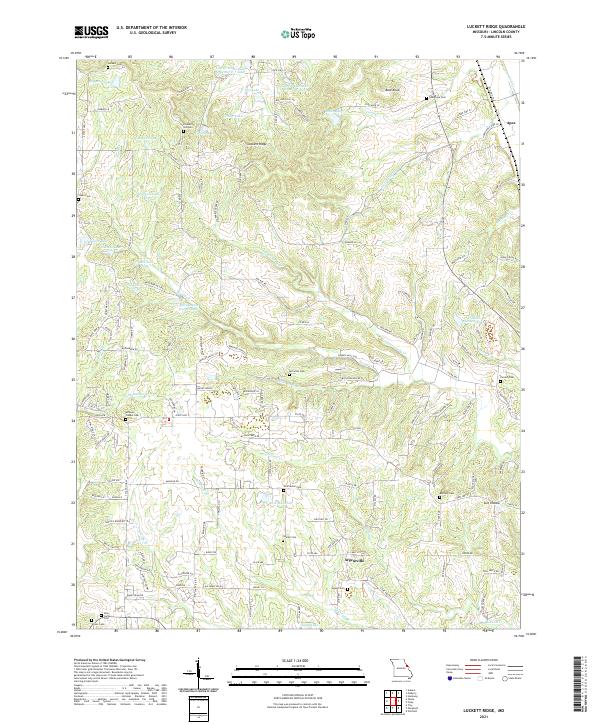
2021 Map of Luckett Ridge
USGS Topo · Published 2021About this map
Luckett Ridge stands as a prominent elevation in this Lincoln County landscape, defining the watershed between Sandy Creek and the headwaters of Hurricane Creek. The area is characterized by a high density of rural cemeteries, such as Pleasant Hill Cem, Star Hope Cem, and Ashbury Chapel Cem, indicating long-established family homesteads and community centers in this part of Missouri. Small settlements like Argentville and Apex anchor the local road network, which follows the natural ridgelines and creek valleys.
Find a feature on this map
147 named features on this map. Tap any name to fly to it.
Don’t see what you’re looking for? This feature index may not catch every label — zoom into the map to look around manually.
Map Details
Editions of this 2021 Luckett Ridge Map
This is the sole edition of this map. No revisions or reprints were ever made.
Other maps of this area

1903 · O'Fallon
USGS Topo · 1:125,000

1930 · Hardin
USGS Topo · 1:62,500

1931 · Brussels
USGS Topo · 1:62,500

1934 · Elsberry
USGS Topo · 1:48,000

1934 · Hardin
USGS Topo · 1:62,500

1938 · Hardin
USGS Topo · 1:62,500

1939 · Brussels
USGS Topo · 1:62,500

1941 · Troy
USGS Topo · 1:62,500

1942 · Elsberry
USGS Topo · 1:62,500

1943 · Brussels
USGS Topo · 1:62,500