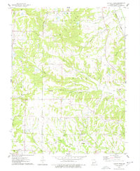
1975 Map of Luckett Ridge
USGS Topo · Published 1977About this map
Luckett Ridge dominates this portion of Lincoln County, where the landscape is defined by the winding drainages of Upper Sandy Creek and Hurricane Creek. Small rural settlements like Apex and Argentville serve as anchors for a community deeply rooted in the land. The map reveals a dense network of family and community history, evidenced by numerous burial sites such as McCullen Cem and Overall Cem, alongside local spiritual centers like Luckett Chapel and Star Hope Ch.
Find a feature on this map
37 named features on this map. Tap any name to fly to it.
Don’t see what you’re looking for? This feature index may not catch every label — zoom into the map to look around manually.
Map Details
Editions of this 1975 Luckett Ridge Map
This is the sole edition of this map. No revisions or reprints were ever made.
Other maps of this area

1903 · O'Fallon
USGS Topo · 1:125,000

1930 · Hardin
USGS Topo · 1:62,500

1931 · Brussels
USGS Topo · 1:62,500

1934 · Elsberry
USGS Topo · 1:48,000

1934 · Hardin
USGS Topo · 1:62,500

1938 · Hardin
USGS Topo · 1:62,500

1939 · Brussels
USGS Topo · 1:62,500

1941 · Troy
USGS Topo · 1:62,500

1942 · Elsberry
USGS Topo · 1:62,500

1943 · Brussels
USGS Topo · 1:62,500