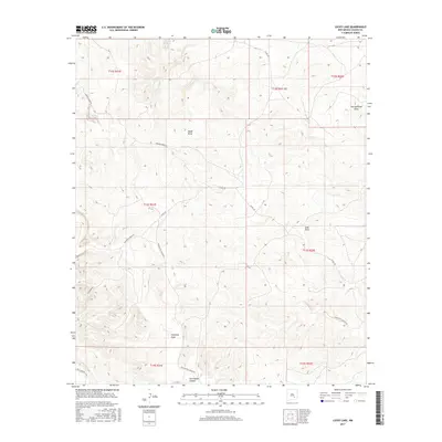
2017 Map of Lucky Lake
USGS Topo · Published 2017About this map
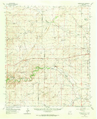
Lucky Lake and Deep Lake sit at the northern edge of this high-plains landscape, where the Chaves County terrain is defined by a series of significant erosional drainages. The topography is marked by deeply incised paths such as Antelope Draw and Thirteenmile Draw, which navigate the subtle elevation shifts of the Permian Basin. This 2017 survey illustrates the intersection of public land survey sections with a sparse but critical road network, including Buchanan Draw Rd and Johnson Draw Rd. The southern portion of the quadrangle is dominated by Twin Butte Canyon, a prominent geological feature that shapes the local drainage patterns. These named draws and canyons reveal the historical water-carved geography of the region, providing essential context for land use and ranching history in southeastern New Mexico.
Find a feature on this map
21 named features on this map. Tap any name to fly to it.
Don’t see what you’re looking for? This feature index may not catch every label — zoom into the map to look around manually.
Map Details
Editions of this 2017 Lucky Lake Map
This is the sole edition of this map. No revisions or reprints were ever made.
Other maps of this area
1949 · Hondo Reservoir
USGS Topo · 1:24,000
1949 · Juan Lake
USGS Topo · 1:24,000
1955 · Kincaid Ranch
USGS Topo · 1:24,000

1955 · Roswell
USGS Topo · 1:250,000
1956 · Diamond A Ranch
USGS Topo · 1:24,000

1958 · Roswell
USGS Topo · 1:250,000
1959 · Diamond A Ranch
USGS Topo · 1:24,000
1961 · Indian Bluff
USGS Topo · 1:62,500
1962 · Roswell
USGS Topo · 1:250,000
1962 · Horseshoe Bend
USGS Topo · 1:62,500