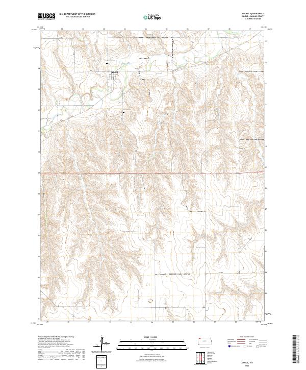
2022 Map of Ludell
USGS Topo · Published 2022About this map
Ludell sits along the northern valley of Beaver Cr in this rural Rawlins County landscape. The settlement is positioned at the intersection of local section lines, surrounded by a high plains topography defined by the drainage patterns of the creek and its numerous unnamed tributaries. The area reflects a late-twentieth and early-twenty-first-century agricultural layout, with a structured grid of rural roads including RD V, RD U, and Co RD 439. Genealogists and local historians can locate established burial grounds in the vicinity, specifically Immanuel Cem just north of the village and Rose Hill Cem situated to the south. The mapping detail shows the varied elevation transitions from the creek bed up to the surrounding prairie tablelands, documented through the surveys of the U.S. Geological Survey and other federal agencies.
Find a feature on this map
20 named features on this map. Tap any name to fly to it.
Don’t see what you’re looking for? This feature index may not catch every label — zoom into the map to look around manually.
Map Details
Editions of this 2022 Ludell Map
This is the sole edition of this map. No revisions or reprints were ever made.
Other maps of this area

1951 · Herndon
USGS Topo · 1:62,500

1951 · Achilles
USGS Topo · 1:62,500

1951 · Atwood
USGS Topo · 1:62,500

1951 · Chardon
USGS Topo · 1:62,500

1954 · Goodland
USGS Topo · 1:250,000

1956 · Goodland
USGS Topo · 1:250,000

1957 · Goodland
USGS Topo · 1:250,000

1965 · Achilles
USGS Topo · 1:24,000
1978 · Atwood
USGS Topo · 1:24,000
1978 · Herndon
USGS Topo · 1:24,000