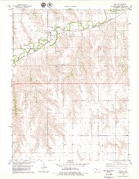
1978 Map of Ludell
USGS Topo · Published 1979About this map
Beaver Creek meanders across the northern plains of Rawlins County, providing the primary hydrological feature for this high-plains landscape. The small settlement of Ludell serves as a local hub, situated where the Burlington Northern railroad follows the low-lying valley floor. The map records several early burial sites, including Immanuel Cem and Ludell Cem, which are vital markers for local family history and genealogy. The surrounding terrain is divided into large townships such as Atwood, Ludell, Herndon, and Union, reflecting the systematic agricultural partitioning of the Kansas prairie. Industrial activity is indicated by several Sandpits and a Quarry, suggesting the extraction of local materials for road building and construction during the late 1970s.
Find a feature on this map
13 named features on this map. Tap any name to fly to it.
Don’t see what you’re looking for? This feature index may not catch every label — zoom into the map to look around manually.
Map Details
Editions of this 1978 Ludell Map
This is the sole edition of this map. No revisions or reprints were ever made.
Other maps of this area

1951 · Herndon
USGS Topo · 1:62,500

1951 · Achilles
USGS Topo · 1:62,500

1951 · Atwood
USGS Topo · 1:62,500

1951 · Chardon
USGS Topo · 1:62,500

1954 · Goodland
USGS Topo · 1:250,000

1956 · Goodland
USGS Topo · 1:250,000

1957 · Goodland
USGS Topo · 1:250,000

1965 · Achilles
USGS Topo · 1:24,000
1978 · Atwood
USGS Topo · 1:24,000
1978 · Herndon
USGS Topo · 1:24,000