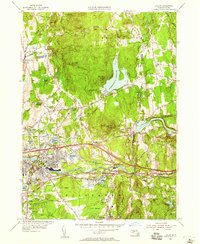
1954 Map of Ludlow
USGS Topo · Published 1958About this map
The Chicopee River serves as the industrial and geographic anchor of this mid-century landscape, threading through the growing communities of Indian Orchard and Ludlow. This 1954 revision documents the early impact of the Massachusetts Turnpike, added to the sheet in 1958, which cuts an engineered path across the traditional rail corridors of the Boston and Albany Railroad and the Central Vermont Railway. The terrain is defined by the prominent Facing Hills and Minechoag Mtn, contrasting with the managed waters of the Springfield Reservoir. Genealogists and local historians can pinpoint institutional and community landmarks like the Wilbraham Academy and Old Wilbraham Cem, alongside modern infrastructure such as the USAF Radio Range Towers and a local Drive-in Theater. This transition from rural hill towns to a suburban-industrial hub is evident in the dense street grids appearing around Ludlow City compared to the open spaces of Sunset Ridge.
Find a feature on this map
84 named features on this map. Tap any name to fly to it.
Don’t see what you’re looking for? This feature index may not catch every label — zoom into the map to look around manually.
Map Details
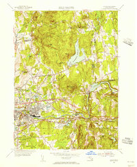
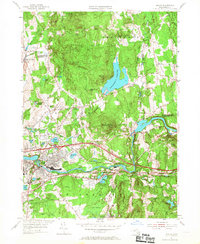
Editions of this 1954 Ludlow Map
3 editions found
Other maps of this area

1885 · Northampton
USGS Topo · 1:62,500

1886 · Springfield
USGS Topo · 1:62,500

1886 · Northampton
USGS Topo · 1:62,500

1887 · Palmer
USGS Topo · 1:62,500

1887 · Belchertown
USGS Topo · 1:62,500

1889 · Springfield
USGS Topo · 1:62,500

1889 · Palmer
USGS Topo · 1:62,500

1890 · Belchertown
USGS Topo · 1:62,500

1891 · Northampton
USGS Topo · 1:62,500

1893 · Northampton
USGS Topo · 1:62,500