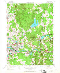
1954 Map of Ludlow
USGS Topo · Published 1967About this map
Chicopee River defines the industrial and residential corridors of this landscape, anchoring settlements like Indian Orchard and North Wilbraham. The mid-century development is marked by the presence of the Massachusetts Turnpike, which cuts through the valley near Ludlow, while older transportation roots are visible via the Boston and Maine RR. To the north, the terrain rises into the Facing Hills and Minechoag Mtn, where the large Springfield Reservoir serves as a dominant hydrologic feature.
Find a feature on this map
69 named features on this map. Tap any name to fly to it.
Don’t see what you’re looking for? This feature index may not catch every label — zoom into the map to look around manually.
Map Details
Editions of this 1954 Ludlow Map
3 editions found
Other maps of this area

1885 · Northampton
USGS Topo · 1:62,500

1886 · Springfield
USGS Topo · 1:62,500

1886 · Northampton
USGS Topo · 1:62,500

1887 · Palmer
USGS Topo · 1:62,500

1887 · Belchertown
USGS Topo · 1:62,500

1889 · Springfield
USGS Topo · 1:62,500

1889 · Palmer
USGS Topo · 1:62,500

1890 · Belchertown
USGS Topo · 1:62,500

1891 · Northampton
USGS Topo · 1:62,500

1893 · Northampton
USGS Topo · 1:62,500