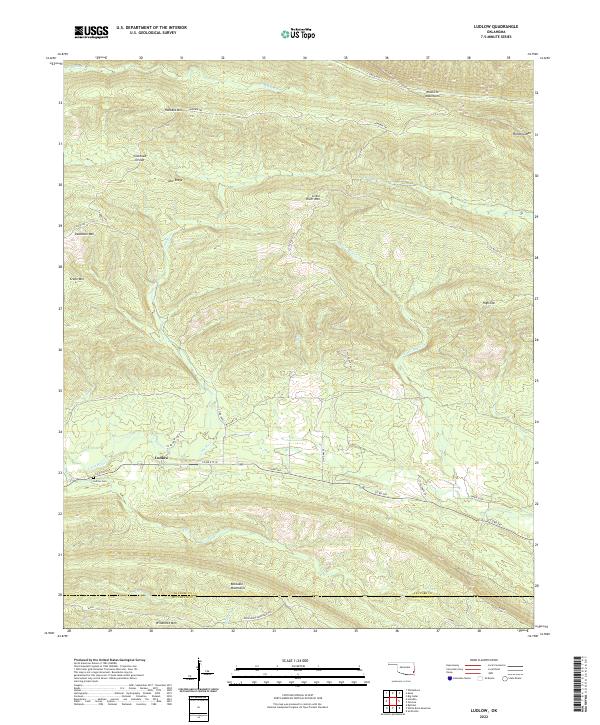
2022 Map of Ludlow
USGS Topo · Published 2022About this map
Ludlow serves as the central settlement in this portion of the Kiamichi Mountains, where the winding path of the Little River carves through the terrain. The landscape is defined by high ridges and peaks, including Honobia Mtn, Deadman Mtn, and Crane Mtn, which separate the various creek drainages. Transport in this part of Le Flore County relies on established routes such as Honobia Trl and Little Eagle Trl, which navigate the complex topography of Cowhead Divide and Doe Ridge. Local history is anchored by the Ludlow Cem, located just north of the river. The southern portion of the map transitions into the Boktuklo Mountains, where Little Rock Cr and Boktuklo Cr flow, illustrating a drainage system that has historically shaped the remote communities and land use patterns of southeast Oklahoma.
Find a feature on this map
43 named features on this map. Tap any name to fly to it.
Don’t see what you’re looking for? This feature index may not catch every label — zoom into the map to look around manually.
Map Details
Editions of this 2022 Ludlow Map
This is the sole edition of this map. No revisions or reprints were ever made.
Other maps of this area

1900 · Winding Stair
USGS Topo · 1:125,000

1902 · Lukfata
USGS Topo · 1:125,000

1909 · Winding Stair
USGS Topo · 1:125,000

1950 · Mcalester
USGS Topo · 1:250,000

1959 · Page
USGS Topo · 1:62,500

1960 · Bethel
USGS Topo · 1:62,500

1960 · Smithville
USGS Topo · 1:62,500

1962 · McAlester
USGS Topo · 1:250,000

1965 · McAlester
USGS Topo · 1:250,000
1966 · Muse
USGS Topo · 1:24,000