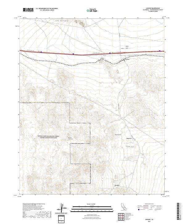
2021 Map of Ludlow
USGS Topo · Published 2021About this map
Ludlow serves as a lonely desert crossroads in the central Mojave Desert, where the National Trails Hwy and Ludlow Rd meet against the backdrop of the Cady Mountains. This 2021 survey illustrates a sparse landscape defined by transport and drainage, featuring the Ludlow Airport and the local Ludlow Cem. To the south, the topography rises sharply into the Bullion Mountains and Swede Hill, separated by broad desert expanses.
Find a feature on this map
23 named features on this map. Tap any name to fly to it.
Don’t see what you’re looking for? This feature index may not catch every label — zoom into the map to look around manually.
Map Details
Editions of this 2021 Ludlow Map
This is the sole edition of this map. No revisions or reprints were ever made.
Other maps of this area

1953 · San Bernardino
USGS Topo · 1:250,000

1954 · Ludlow SE
USGS Topo · 1:24,000

1955 · Ludlow
USGS Topo · 1:24,000

1955 · Lavic SE
USGS Topo · 1:24,000

1955 · Morgans Well
USGS Topo · 1:24,000

1955 · Ash Hill
USGS Topo · 1:24,000

1955 · Lavic Lake
USGS Topo · 1:24,000

1955 · Lavic
USGS Topo · 1:62,500

1955 · Cady Mountains
USGS Topo · 1:62,500

1955 · Broadwell Lake
USGS Topo · 1:62,500