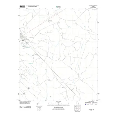
2011 Map of Ludowici
USGS Topo · Published 2011About this map
Ludowici serves as the focal point for this Southeast Georgia landscape, where a transition from town streets to expansive lowlands defines the local geography. Significant for genealogists and local historians, the sheet identifies numerous burial grounds scattered across the countryside, including Concord Cemetery, Sharp Cemetery, and the uniquely named Strangers Cemetery. The hydrology of the area is dominated by the meandering path of Doctors Creek, which flows southward toward the Goose Run Creek drainage, and man-made features such as the Smiley Pond Dam. Beyond the settlement, the terrain shifts into a series of named islands and ridges within the swampy river bottomlands, notably Pine Island and the elevated Board Pile Ridges. These features, alongside landmarks like the Ludowici Post Office and the Ivy Melvin Hendrix Junior Bridge, document the infrastructure and community layout of Long County during the early 21st century.
Find a feature on this map
54 named features on this map. Tap any name to fly to it.
Don’t see what you’re looking for? This feature index may not catch every label — zoom into the map to look around manually.
Map Details
Editions of this 2011 Ludowici Map
This is the sole edition of this map. No revisions or reprints were ever made.
Other maps of this area

1918 · Jesup
USGS Topo · 1:62,500

1918 · Hinesville
USGS Topo · 1:62,500

1920 · Glennville
USGS Topo · 1:62,500

1943 · Ludowici
USGS Topo · 1:62,500

1943 · Jesup
USGS Topo · 1:62,500

1944 · Glennville
USGS Topo · 1:62,500

1944 · Hinesville
USGS Topo · 1:62,500

1946 · Brunswick
USGS Topo · 1:250,000

1948 · Brunswick
USGS Topo · 1:250,000

1950 · Glennville
USGS Topo · 1:62,500