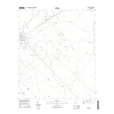
2014 Map of Ludowici
USGS Topo · Published 2014About this map
Ludowici serves as the focal point of this Long County landscape, situated at the junction of the CSX railroad and major regional arteries like Us-84 and Ga-57. The surrounding terrain is defined by a intricate network of drainage, where Doctors Cr and Goose Run Cr thread through low-lying areas, occasionally opening into named clearings such as Pine Island and Gill Island. These wetlands and ridges, including the curiously named Board Pile Ridges, underscore the area's timber and transit roots.
Find a feature on this map
77 named features on this map. Tap any name to fly to it.
Don’t see what you’re looking for? This feature index may not catch every label — zoom into the map to look around manually.
Map Details
Editions of this 2014 Ludowici Map
This is the sole edition of this map. No revisions or reprints were ever made.
Other maps of this area

1918 · Jesup
USGS Topo · 1:62,500

1918 · Hinesville
USGS Topo · 1:62,500

1920 · Glennville
USGS Topo · 1:62,500

1943 · Ludowici
USGS Topo · 1:62,500

1943 · Jesup
USGS Topo · 1:62,500

1944 · Glennville
USGS Topo · 1:62,500

1944 · Hinesville
USGS Topo · 1:62,500

1946 · Brunswick
USGS Topo · 1:250,000

1948 · Brunswick
USGS Topo · 1:250,000

1950 · Glennville
USGS Topo · 1:62,500