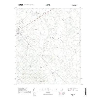
2020 Map of Ludowici
USGS Topo · Published 2020About this map
The Long County Courthouse stands as the central landmark of Ludowici, a community defined by its proximity to the vast wetlands of the Georgia coastal plain. In this 2020 survey, the town's grid gives way to a sprawling network of dirt roads and timber tracks that penetrate the surrounding bottomlands. To the south and east, the terrain dissolves into a complex system of named swamps and rises, including Bull Town Swamp and Board Pile Ridges. Local genealogy is well-represented through numerous burial sites like Citizens Cem, Robert Middleton Cem, and the uniquely named Strangers Cem. The landscape is dominated by water, with S Newport River and Goose Run Cr threading through the eastern quadrant. Unusual topographical features such as Gator Head and the isolated highland of Pine Island illustrate the subtle elevation shifts that dictate settlement and transit in this part of Long County.
Find a feature on this map
91 named features on this map. Tap any name to fly to it.
Don’t see what you’re looking for? This feature index may not catch every label — zoom into the map to look around manually.
Map Details
Editions of this 2020 Ludowici Map
This is the sole edition of this map. No revisions or reprints were ever made.
Other maps of this area

1918 · Jesup
USGS Topo · 1:62,500

1918 · Hinesville
USGS Topo · 1:62,500

1920 · Glennville
USGS Topo · 1:62,500

1943 · Ludowici
USGS Topo · 1:62,500

1943 · Jesup
USGS Topo · 1:62,500

1944 · Glennville
USGS Topo · 1:62,500

1944 · Hinesville
USGS Topo · 1:62,500

1946 · Brunswick
USGS Topo · 1:250,000

1948 · Brunswick
USGS Topo · 1:250,000

1950 · Glennville
USGS Topo · 1:62,500