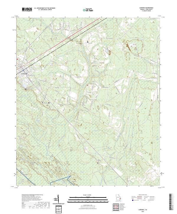
2024 Map of Ludowici
USGS Topo · Published 2024About this map
The Long County Courthouse in Ludowici serves as the focal point for this Southeast Georgia landscape, where the coastal plain gives way to an intricate system of wetlands and small family burial grounds. The mapping of cemeteries like Strangers Cem, Baggs Cem, and the Robert Middleton Cem provides essential spatial data for genealogists tracing local lineage in Long County. To the east and south, the terrain is defined by the South Newport River and the expansive TBR Main swamp, interspersed with family-named land features such as Beaver Hill and Pine Island. These hydrological features, including Doctors Creek and the dark waters of Black Calico, illustrate the traditional drainage patterns that have historically dictated the placement of roads and homesteads in the region.
Find a feature on this map
94 named features on this map. Tap any name to fly to it.
Don’t see what you’re looking for? This feature index may not catch every label — zoom into the map to look around manually.
Map Details
Editions of this 2024 Ludowici Map
This is the sole edition of this map. No revisions or reprints were ever made.
Other maps of this area

1918 · Jesup
USGS Topo · 1:62,500

1918 · Hinesville
USGS Topo · 1:62,500

1920 · Glennville
USGS Topo · 1:62,500

1943 · Ludowici
USGS Topo · 1:62,500

1943 · Jesup
USGS Topo · 1:62,500

1944 · Glennville
USGS Topo · 1:62,500

1944 · Hinesville
USGS Topo · 1:62,500

1946 · Brunswick
USGS Topo · 1:250,000

1948 · Brunswick
USGS Topo · 1:250,000

1950 · Glennville
USGS Topo · 1:62,500