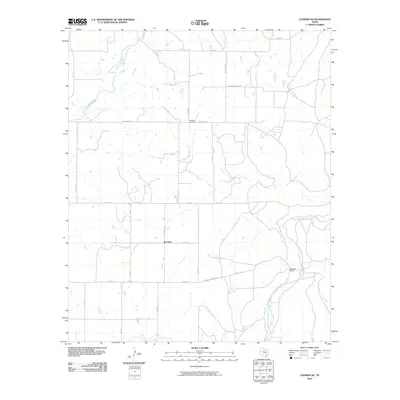
2010 Map of Lueders NE
USGS Topo · Published 2010About this map
The Clear Fork Brazos River winds through the eastern portion of this West Texas landscape, serving as a primary drainage point for tributaries like California Creek, Pinto Creek, and Fish Creek. The area is characterized by large ranching operations and scattered rural settlements, most notably at Berryhill and the Hendrick Ranch. The grid of county roads, including Co Rd 171 and Co Rd 175, defines the modern land use patterns, providing access to remote homesteads and historical sites such as Rockdale Cemetery. This 2010 survey shows a region deeply tied to its water sources and livestock heritage, where long-established private holdings like the Hendrick Ranch and Hendricks Ranch Rd reflect the enduring importance of family-owned ranch land in Shackelford County.
Find a feature on this map
25 named features on this map. Tap any name to fly to it.
Don’t see what you’re looking for? This feature index may not catch every label — zoom into the map to look around manually.
Map Details
Editions of this 2010 Lueders NE Map
This is the sole edition of this map. No revisions or reprints were ever made.
Other maps of this area

1891 · Anson
USGS Topo · 1:125,000

1892 · Albany
USGS Topo · 1:125,000

1893 · Albany
USGS Topo · 1:125,000

1893 · Anson
USGS Topo · 1:125,000

1954 · Abilene
USGS Topo · 1:250,000

1954 · Wichita Falls
USGS Topo · 1:250,000

1958 · Wichita Falls
USGS Topo · 1:250,000

1958 · Abilene
USGS Topo · 1:250,000

1965 · Lueders NW
USGS Topo · 1:24,000

1965 · Lueders NE
USGS Topo · 1:24,000