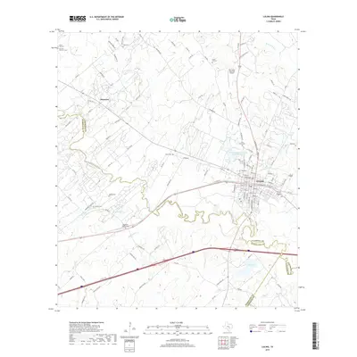
2019 Map of Luling
USGS Topo · Published 2019About this map
The San Marcos River snakes through this Central Texas landscape, defining the boundaries where Caldwell, Guadalupe, and Gonzales counties meet. In the city of Luling, a dense grid of streets like Magnolia Avenue and Bowie Street spreads north of the river, while the surrounding countryside is dotted with legacy burial grounds including Highsmith Cemeteries, Appling Cem, and Marines Cem. This geography reveals a long history of rural settlement, evidenced by the clustered homes at Stairtown and the various cattle and ranch roads like Rawhide Ln and Oaks Ranch Rd.
Find a feature on this map
116 named features on this map. Tap any name to fly to it.
Don’t see what you’re looking for? This feature index may not catch every label — zoom into the map to look around manually.
Map Details
Editions of this 2019 Luling Map
This is the sole edition of this map. No revisions or reprints were ever made.
Other maps of this area

1911 · San Marcos
USGS Topo · 1:125,000

1919 · San Marcos
USGS Topo · 1:125,000

1924 · San Marcos 3-d
USGS Topo · 1:48,000

1925 · San Marcos 4-c
USGS Topo · 1:48,000

1925 · San Marcos 1-d
USGS Topo · 1:48,000

1925 · San Marcos 4-a
USGS Topo · 1:48,000

1929 · Luling
USGS Topo · 1:62,500

1930 · Lockhart
USGS Topo · 1:62,500

1930 · Seguin
USGS Topo · 1:62,500

1953 · Seguin
USGS Topo · 1:250,000