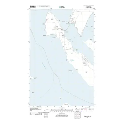
2011 Map of Lummi Island
USGS Topo · Published 2011About this map
Lummi Island and its surrounding waters define this maritime landscape, where the Lummi Island Ferry Landing connects the island to Gooseberry Point across Hale Passage. The northern end of the island is anchored by Richards Mountain and the settlement at Beach, featuring the Lummi Island Post Office and Millers Field. These features highlight a community built around coastal access and local aviation.
Find a feature on this map
81 named features on this map. Tap any name to fly to it.
Don’t see what you’re looking for? This feature index may not catch every label — zoom into the map to look around manually.
Map Details
Editions of this 2011 Lummi Island Map
This is the sole edition of this map. No revisions or reprints were ever made.
Other maps of this area

1907 · Blaine
USGS Topo · 1:62,500

1943 · Orcas Island
USGS Topo · 1:62,500

1943 · Anacortes
USGS Topo · 1:62,500

1951 · Anacortes
USGS Topo · 1:62,500

1952 · Ferndale
USGS Topo · 1:24,000

1952 · Lummi Bay
USGS Topo · 1:24,000

1952 · Blaine
USGS Topo · 1:62,500

1957 · Orcas Island
USGS Topo · 1:62,500

1957 · Victoria
USGS Topo · 1:250,000

1973 · Cypress Island
USGS Topo · 1:24,000