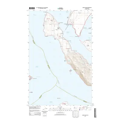
2014 Map of Lummi Island
USGS Topo · Published 2014About this map
Lummi Island is defined by its maritime isolation and rugged topography, rising sharply from the waters of Puget Sound and the Strait of Georgia. In the north, the small community of Beach serves as a focal point near the Lummi Island - Bellingham Ferry terminal, while established sites like Loganita Lodge and The Willows trace the island's long history as a coastal retreat. The southern half of the island is dominated by the steep ascent to Lummi Peak, a prominent landmark overlooking the Rosario Strait.
Find a feature on this map
79 named features on this map. Tap any name to fly to it.
Don’t see what you’re looking for? This feature index may not catch every label — zoom into the map to look around manually.
Map Details
Editions of this 2014 Lummi Island Map
This is the sole edition of this map. No revisions or reprints were ever made.
Other maps of this area

1907 · Blaine
USGS Topo · 1:62,500

1943 · Orcas Island
USGS Topo · 1:62,500

1943 · Anacortes
USGS Topo · 1:62,500

1951 · Anacortes
USGS Topo · 1:62,500

1952 · Ferndale
USGS Topo · 1:24,000

1952 · Lummi Bay
USGS Topo · 1:24,000

1952 · Blaine
USGS Topo · 1:62,500

1957 · Orcas Island
USGS Topo · 1:62,500

1957 · Victoria
USGS Topo · 1:250,000

1973 · Cypress Island
USGS Topo · 1:24,000