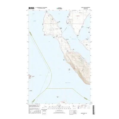
2017 Map of Lummi Island
USGS Topo · Published 2017About this map
Lummi Island is defined by its maritime connections and varied coastal relief, stretching from the northern heights of Richards Mtn to the southern summit of Lummi Peak. The island's geography is punctuated by distinctive landforms like Lummi Lane Point Spit and Bumstead Spit, while the Lummi Island Ferry provides the primary link across Hale Passage to the mainland at Gooseberry Point. Settled areas like West Beach and Hermosa Beach contrast with the more secluded reaches of Smugglers Cove and the steep incline of Devils Slide. Historical and local-history markers such as the Lummi Island Cem and the tidal crossing at The Portage reflect a community shaped by its isolation and the surrounding waters of Puget Sound and the Strait of Georgia. Interior features like Holiday Lake and Baker Reservoir reveal the island's freshwater management alongside its many saltwater points and bluffs.
Find a feature on this map
71 named features on this map. Tap any name to fly to it.
Don’t see what you’re looking for? This feature index may not catch every label — zoom into the map to look around manually.
Map Details
Editions of this 2017 Lummi Island Map
This is the sole edition of this map. No revisions or reprints were ever made.
Other maps of this area

1907 · Blaine
USGS Topo · 1:62,500

1943 · Orcas Island
USGS Topo · 1:62,500

1943 · Anacortes
USGS Topo · 1:62,500

1951 · Anacortes
USGS Topo · 1:62,500

1952 · Ferndale
USGS Topo · 1:24,000

1952 · Lummi Bay
USGS Topo · 1:24,000

1952 · Blaine
USGS Topo · 1:62,500

1957 · Orcas Island
USGS Topo · 1:62,500

1957 · Victoria
USGS Topo · 1:250,000

1973 · Cypress Island
USGS Topo · 1:24,000