
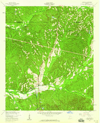
1950 Map of Lumpkin SW
USGS Topo · Published 1953About this map
Providence Canyons dominates this Stewart County landscape, where the deeply eroded gullies of the Red Hills were already a well-established landmark by the mid-20th century. The rural social structure of the era is clearly visible through a dense network of country schools and churches that served scattered farming families. Settlements like Beatrice and institutions such as Oak Grove Sch and Stephen Chapel provide critical points of reference for genealogists. The map also records family-named landmarks like the James Templeton Cem and Elam Cem, which offer significant value for those tracing local family roots. A intricate network of watercourses, including Turner Creek and Tali pahoga Creek, drains the dissected terrain, illustrating the natural boundaries that shaped the region's early road and land patterns.
Find a feature on this map
22 named features on this map. Tap any name to fly to it.
Don’t see what you’re looking for? This feature index may not catch every label — zoom into the map to look around manually.
Map Details
Editions of this 1950 Lumpkin SW Map
This is the sole edition of this map. No revisions or reprints were ever made.
Other maps of this area

1949 · Julia
USGS Topo · 1:24,000

1950 · Louvale
USGS Topo · 1:24,000

1950 · Lumpkin
USGS Topo · 1:24,000

1950 · Lumpkin
USGS Topo · 1:62,500

1953 · Dothan
USGS Topo · 1:250,000

1954 · Dothan
USGS Topo · 1:250,000

1955 · Dothan
USGS Topo · 1:250,000

1955 · Lumpkin
USGS Topo · 1:24,000
1955 · Louvale
USGS Topo · 1:24,000

1955 · Lumpkin SW
USGS Topo · 1:24,000