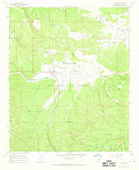
1965 Map of Luna
USGS Topo · Published 1969About this map
Luna Valley serves as the central hub of this mid-1960s landscape, where the San Francisco River meanders through the high country of the Apache National Forest. The settlement of Luna is documented alongside key infrastructure like the Luna Ranger Station and a local Sawmill, reflecting the region's reliance on timber and forest management. Higher elevations are characterized by named landmarks such as Bar NL Mesa and the San Francisco Mountains, while the presence of Indian Ruins near Centerfire Creek suggests a much deeper history of habitation in these canyons.
Find a feature on this map
40 named features on this map. Tap any name to fly to it.
Don’t see what you’re looking for? This feature index may not catch every label — zoom into the map to look around manually.
Map Details
Editions of this 1965 Luna Map
2 editions found
Other maps of this area

1915 · Reserve
USGS Topo · 1:125,000

1918 · Reserve
USGS Topo · 1:125,000

1922 · Nutrioso
USGS Topo · 1:125,000

1954 · Clifton
USGS Topo · 1:250,000

1957 · Clifton
USGS Topo · 1:250,000

1958 · Clifton
USGS Topo · 1:250,000

1958 · Alpine
USGS Topo · 1:62,500

1961 · Blue
USGS Topo · 1:62,500

1962 · Clifton
USGS Topo · 1:250,000
1965 · Reserve
USGS Topo · 1:24,000