
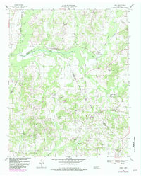
1955 Map of Luray
USGS Topo · Published 1956About this map
The Nashville Chattanooga and St Louis railroad cuts through the center of this rural landscape, following the corridor of the North Fork Forked Deer River through Luray and Huron. This mid-1950s survey captures a transition in West Tennessee, where small community hubs like Mifflin and Russell Crossroads served a network of family farms and local institutions. The distribution of educational and spiritual centers is remarkably dense, featuring several rural schools such as Olive Grove Sch, Brown Sch, and Joyners Grove Sch, alongside community churches like Middle Fork Ch and Unity Ch. The confluence of county lines between Henderson, Madison, and Chester counties defines much of the western edge, while numerous named drainages like Spencer Creek, Cypress Creek, and Clarks Creek illustrate the hydrologic character of the West Tennessee hills before significant modern development altered the rural fabric.
Find a feature on this map
30 named features on this map. Tap any name to fly to it.
Don’t see what you’re looking for? This feature index may not catch every label — zoom into the map to look around manually.
Map Details
Editions of this 1955 Luray Map
2 editions found
Other maps of this area

1936 · Lexington
USGS Topo · 1:24,000

1936 · Enville
USGS Topo · 1:24,000

1936 · Life
USGS Topo · 1:24,000

1950 · Life
USGS Topo · 1:24,000

1950 · Enville
USGS Topo · 1:24,000

1950 · Lexington
USGS Topo · 1:24,000

1953 · Claybrook
USGS Topo · 1:24,000

1953 · Beech Bluff
USGS Topo · 1:24,000

1955 · Juno
USGS Topo · 1:24,000

1956 · Blytheville
USGS Topo · 1:250,000